Shipley’s Grant

Main_Shipleys Grant

Project Description

Client/Builder/Developer:  Bozzuto Group, Inc.
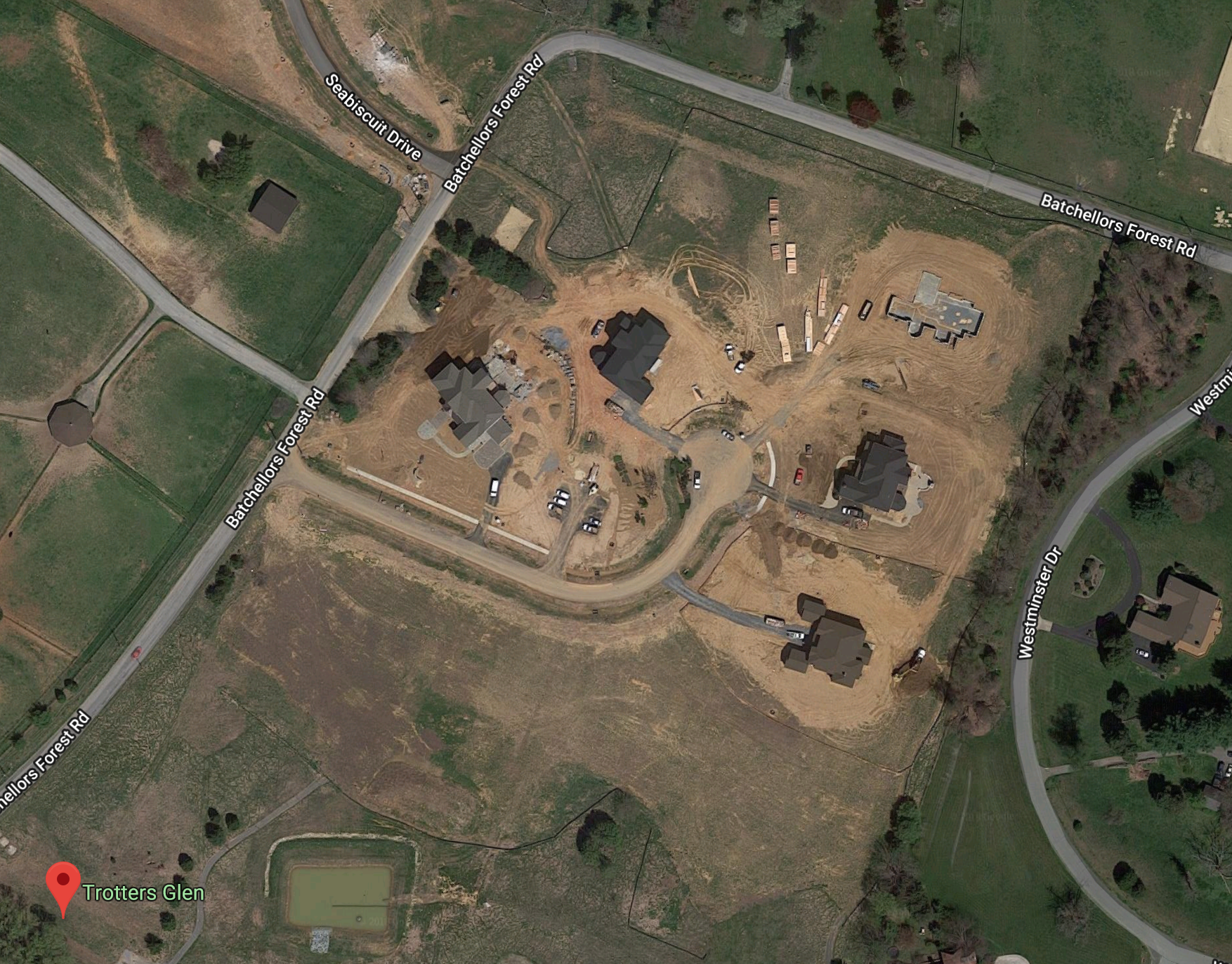
LocationEllicott City, Howard County, MD
Market: Mixed Use – Residential and Retail
Size: 58.6 Acres
Zoning: R-A-15 & B-1
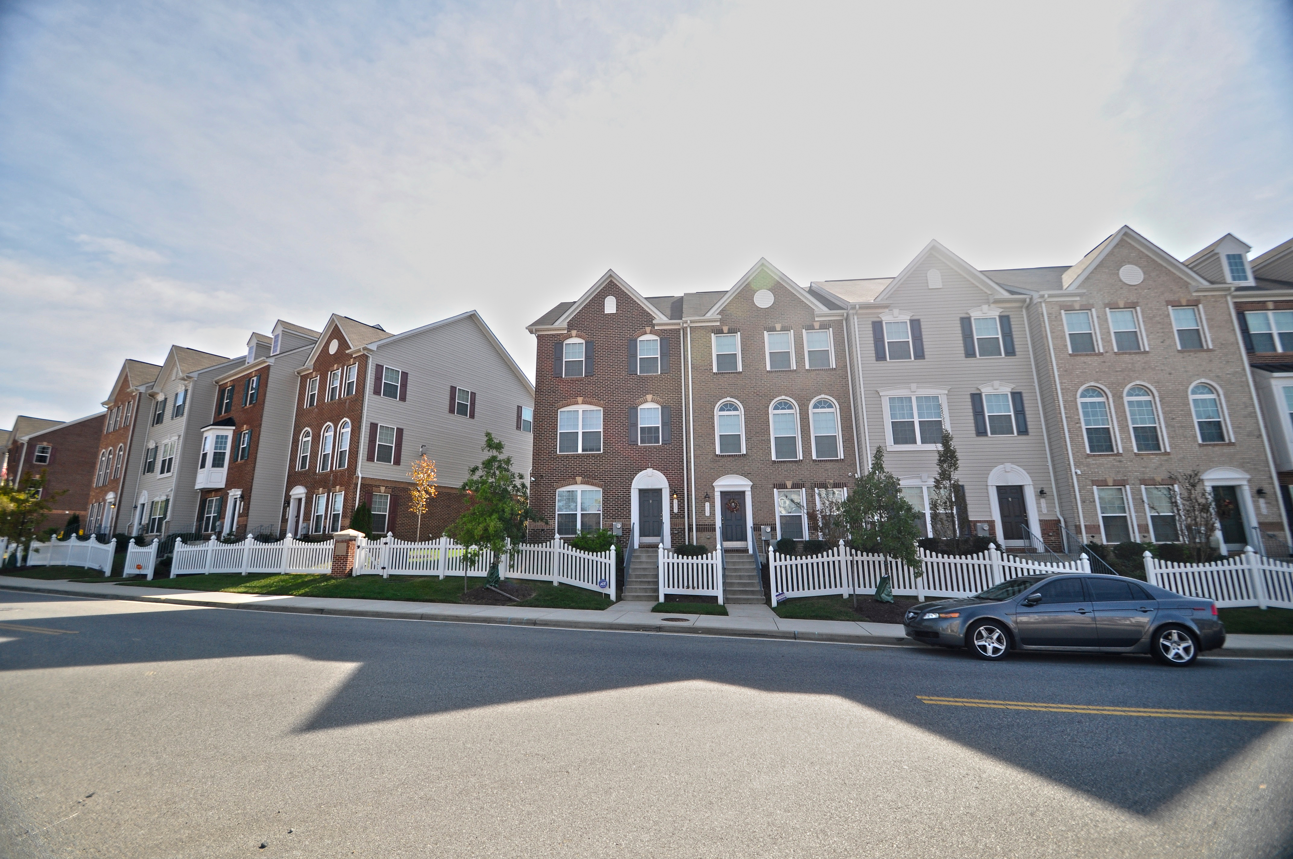
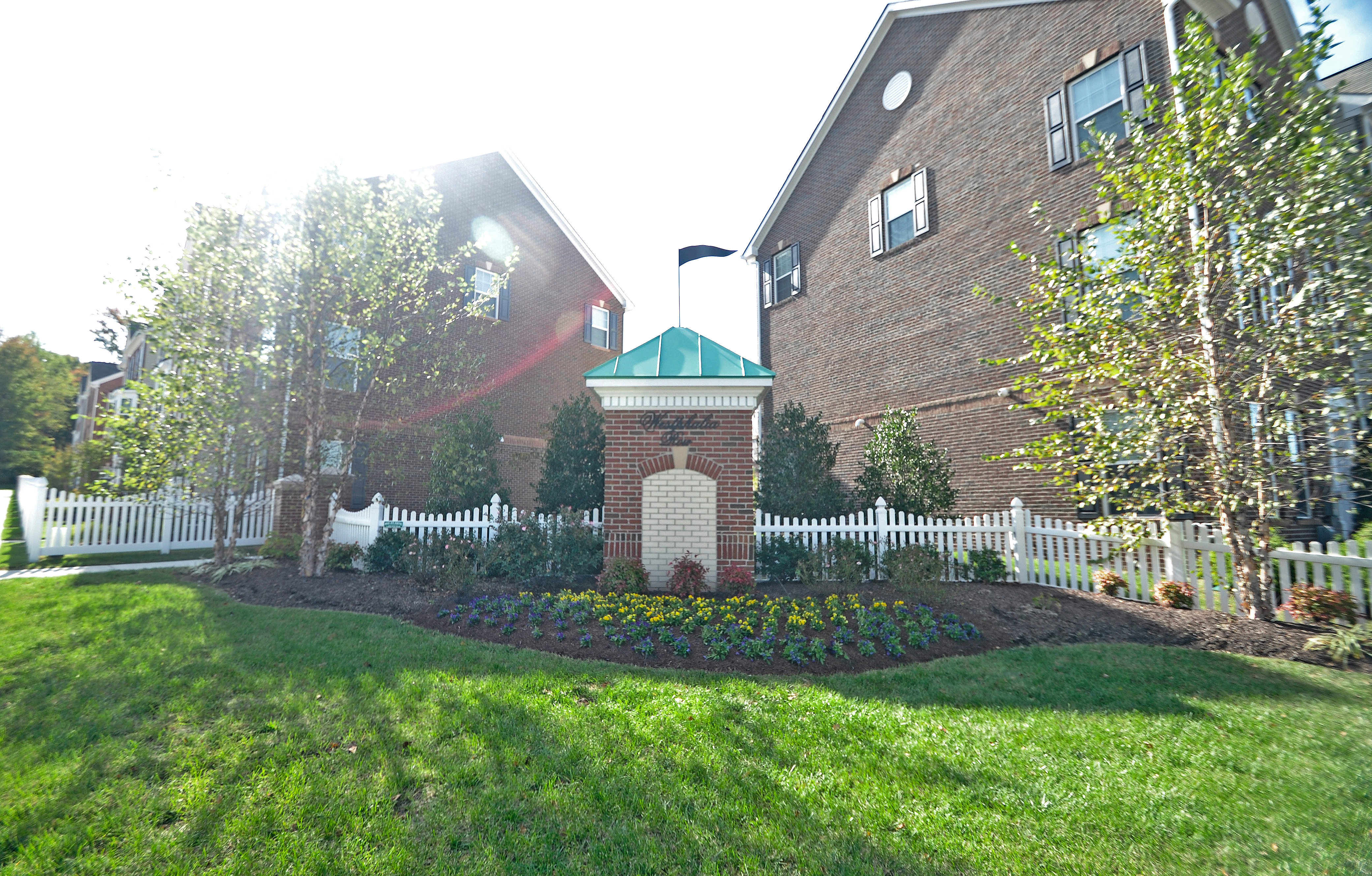
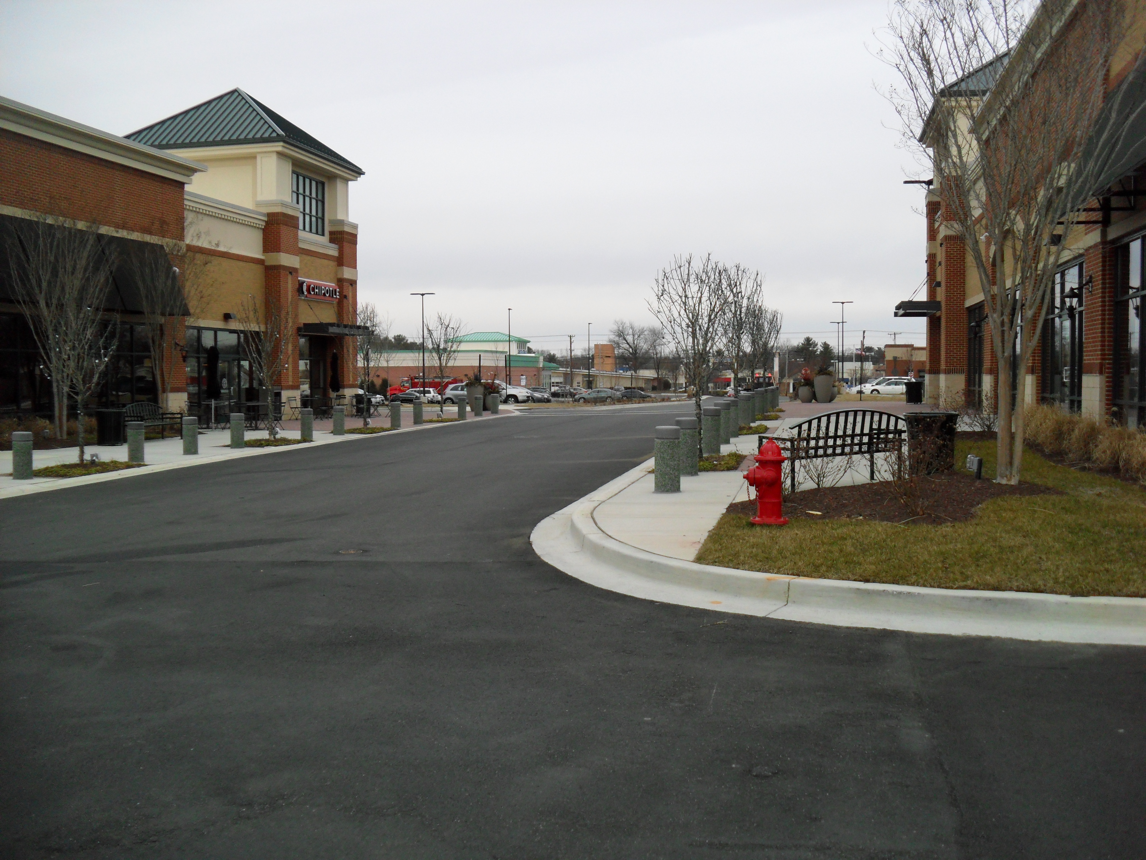
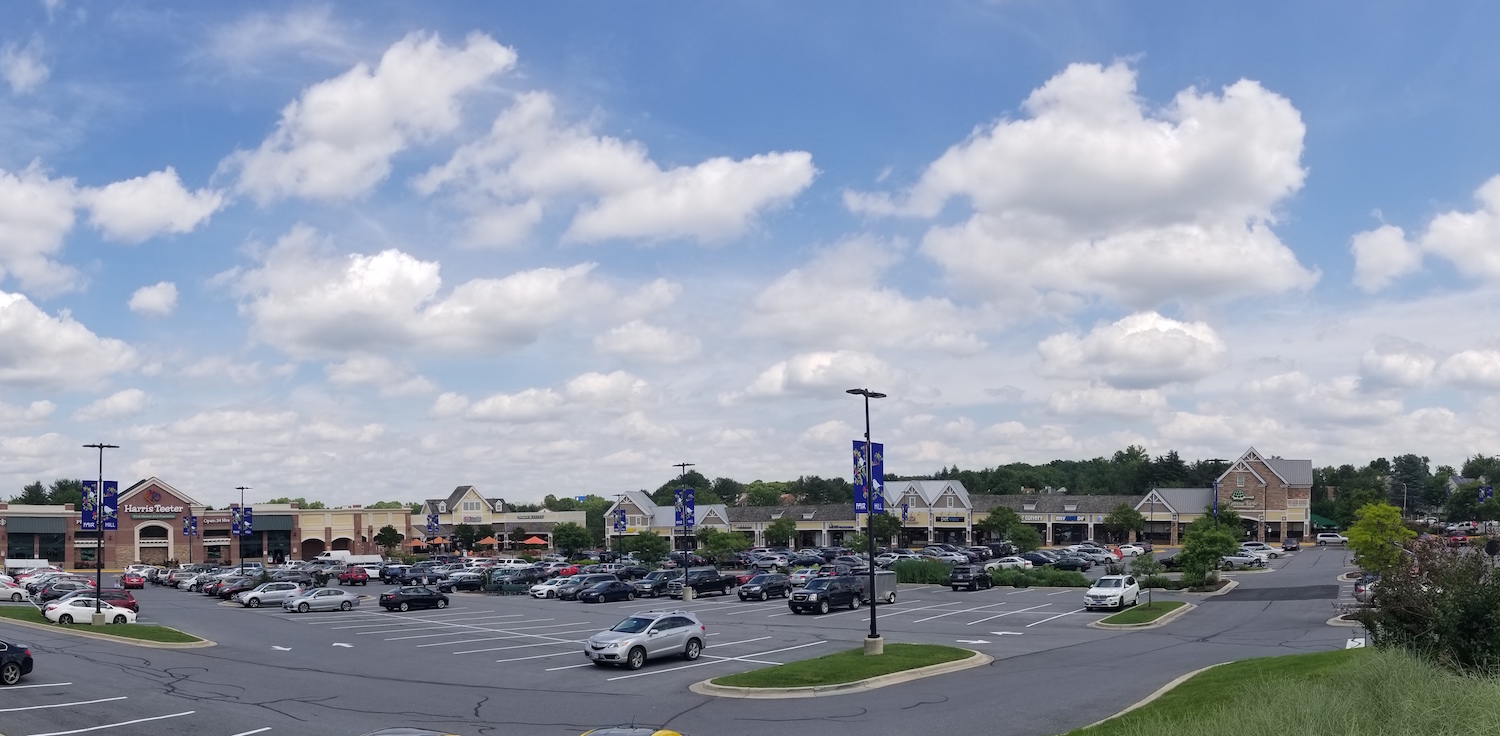
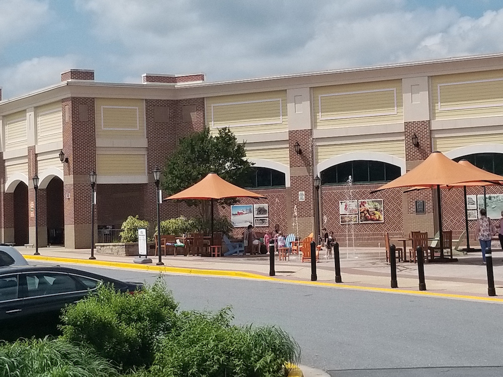
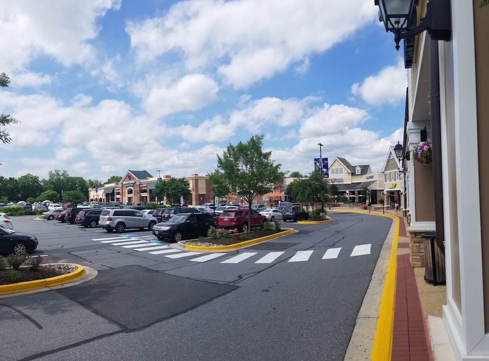
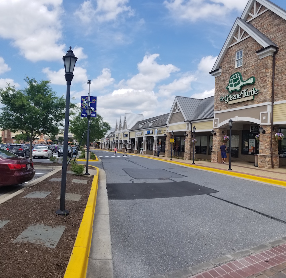
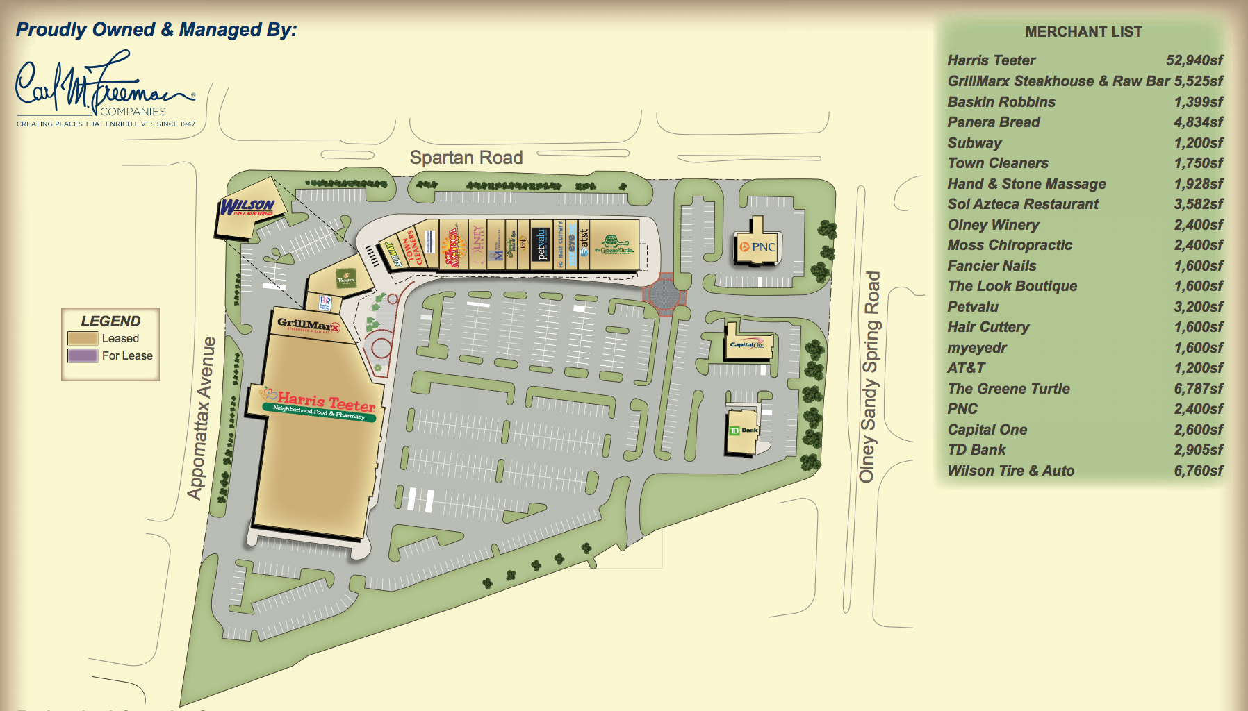
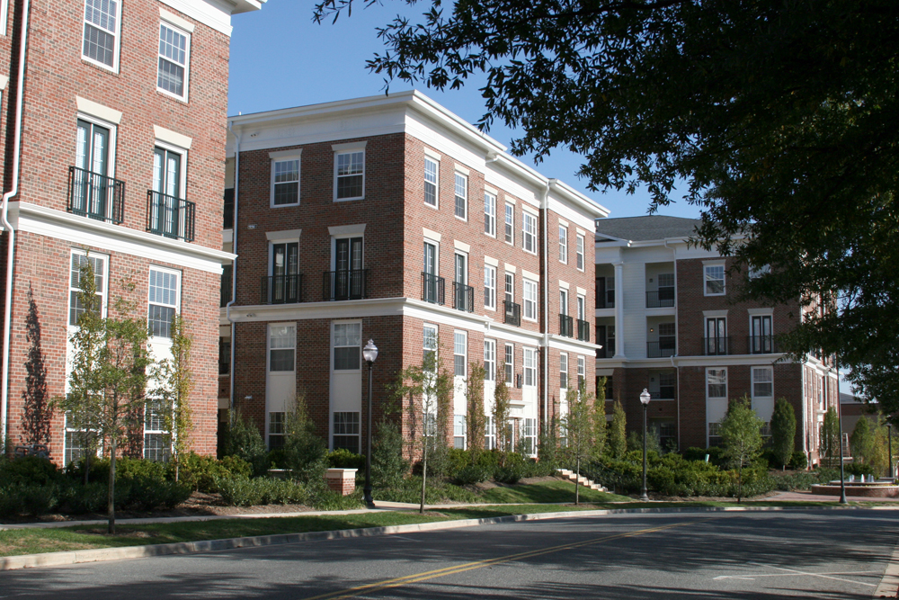
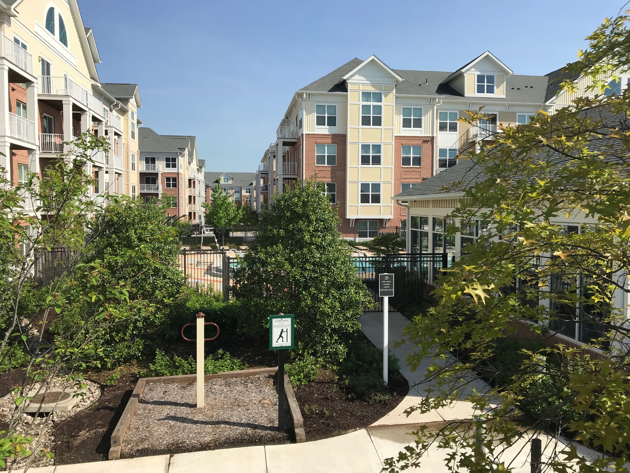
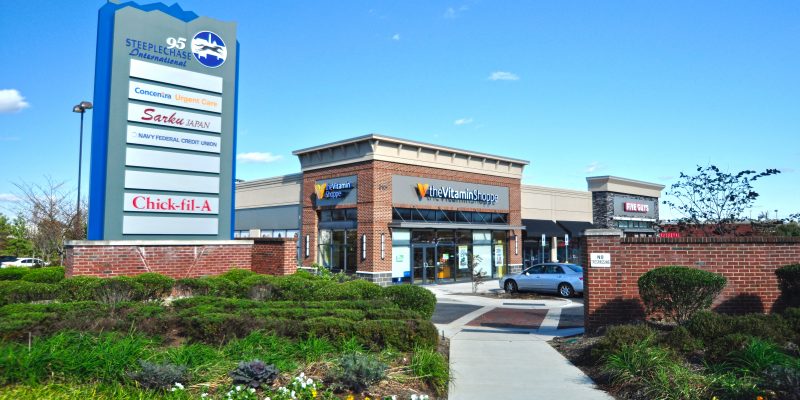
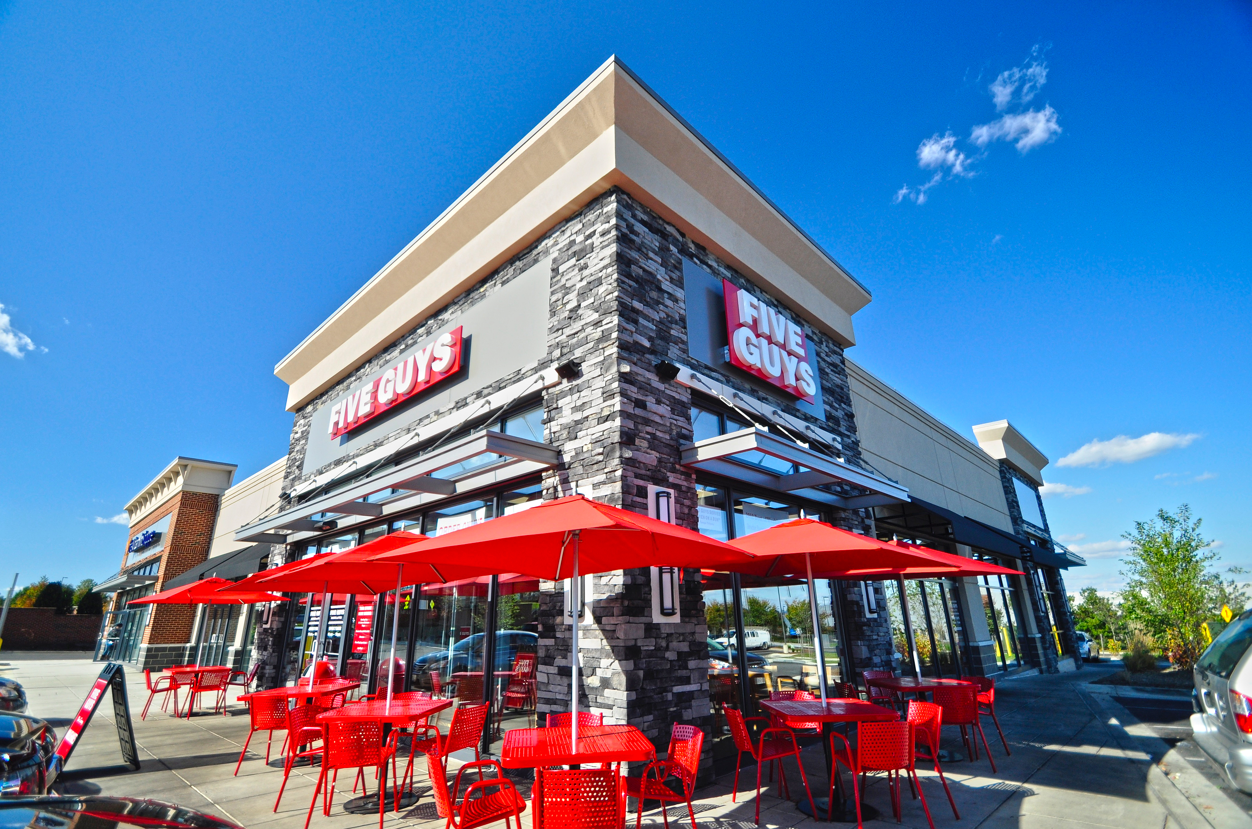
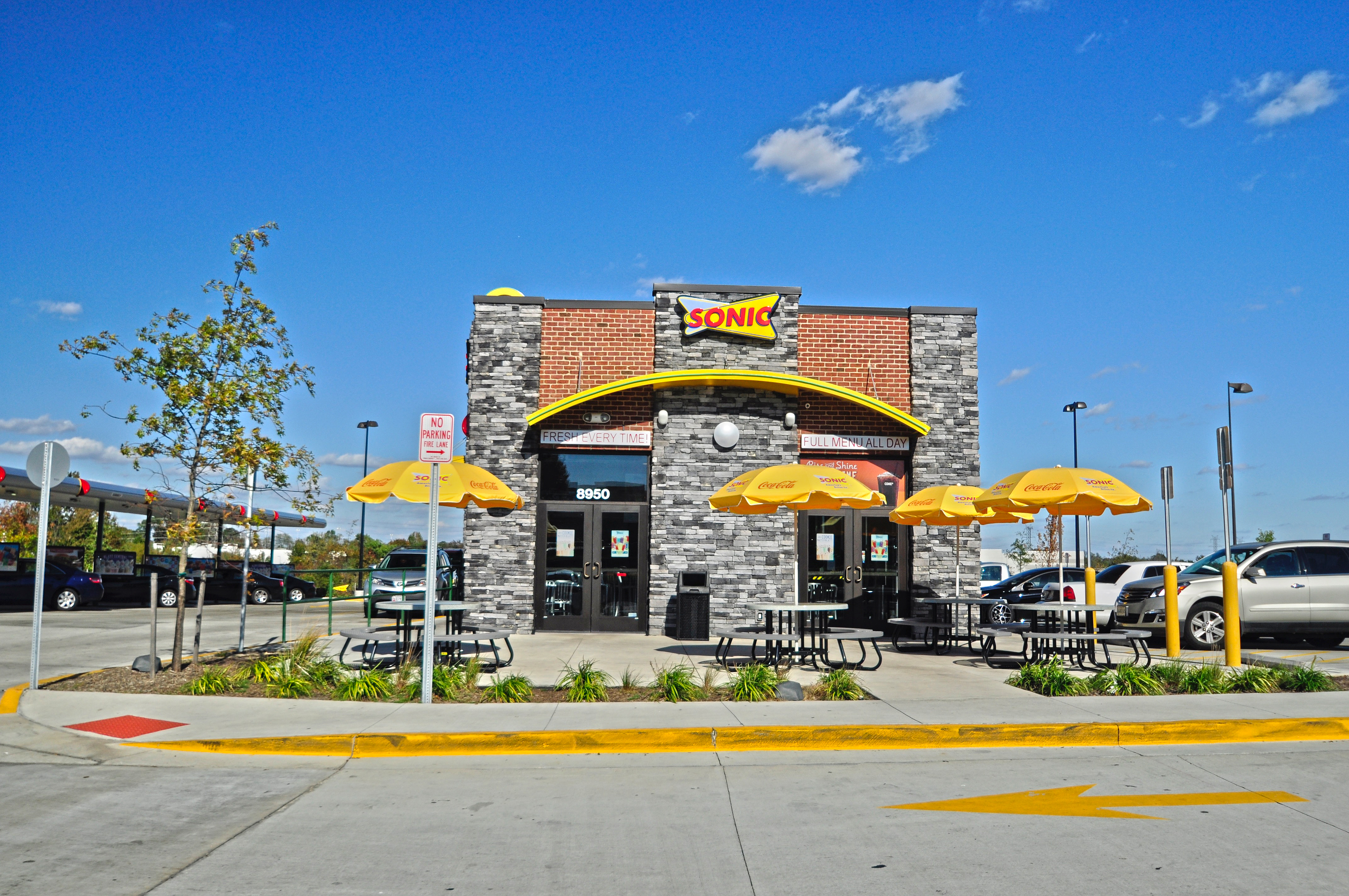
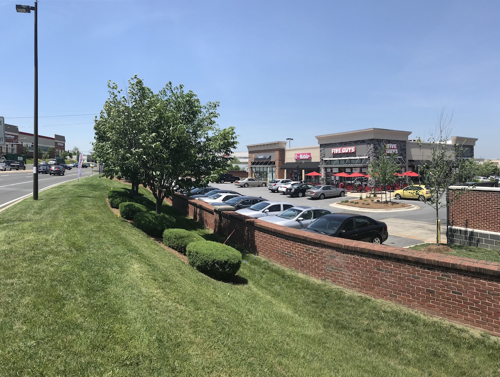
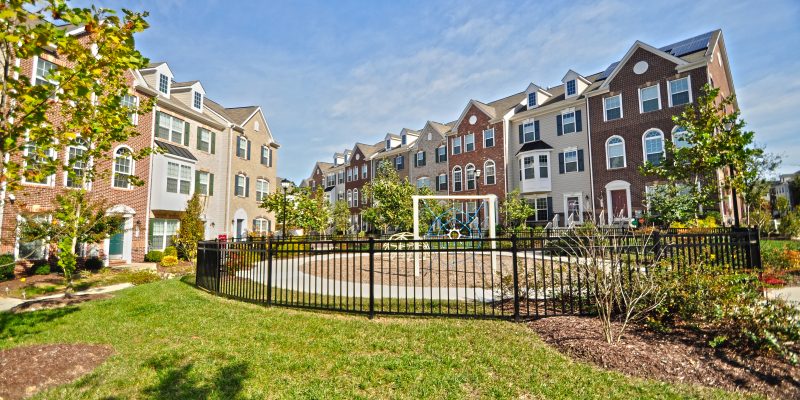
Density: 474 Town homes, 32,446 Square Foot Restaurant & Retail Center

Recent Projects

The Challenges

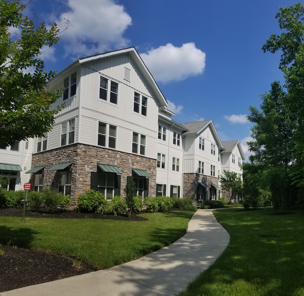
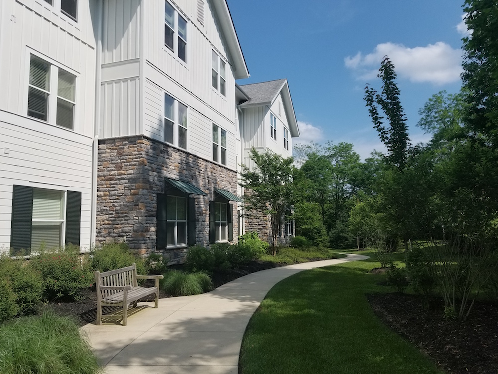
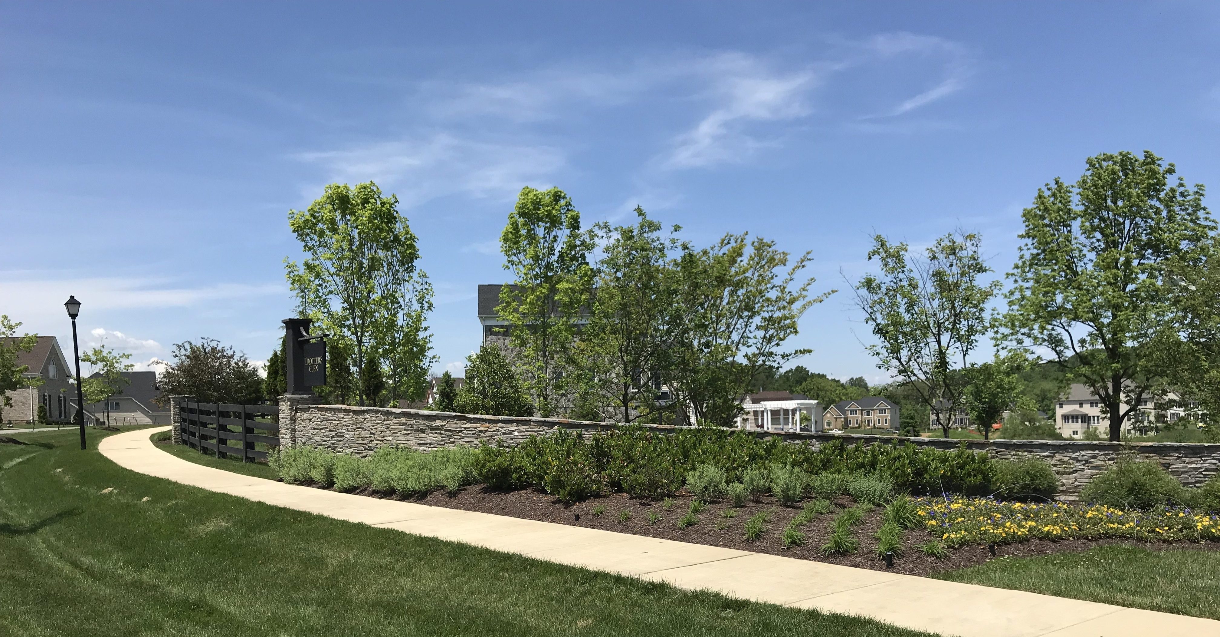
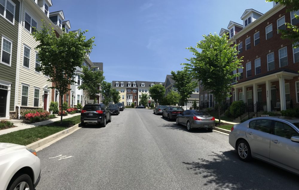
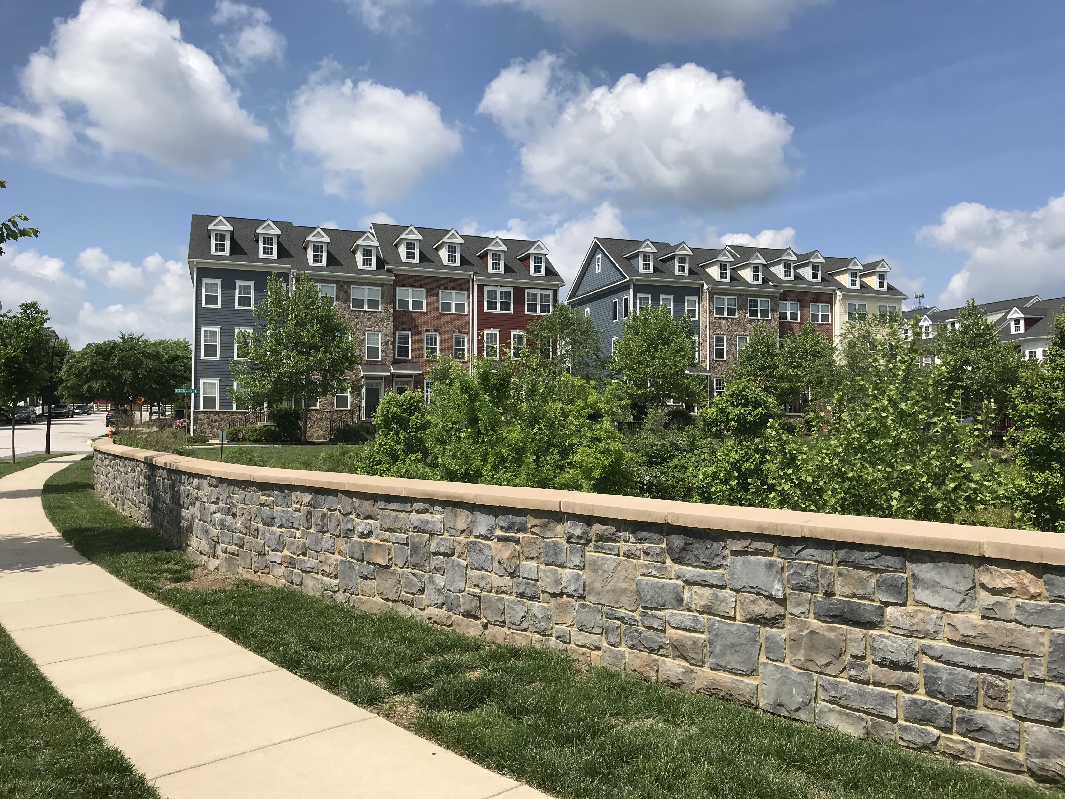
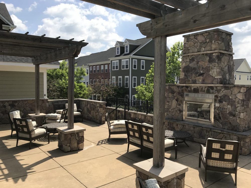
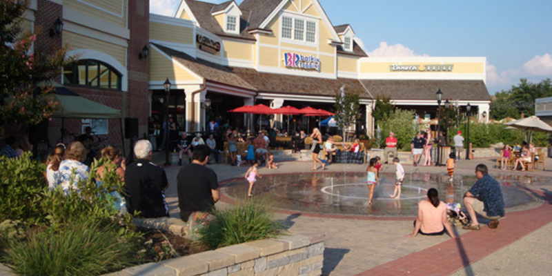
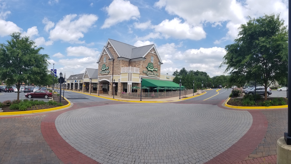
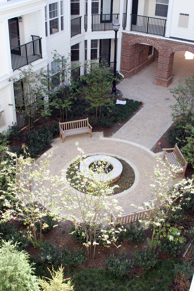
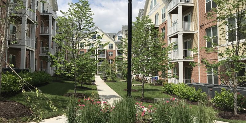
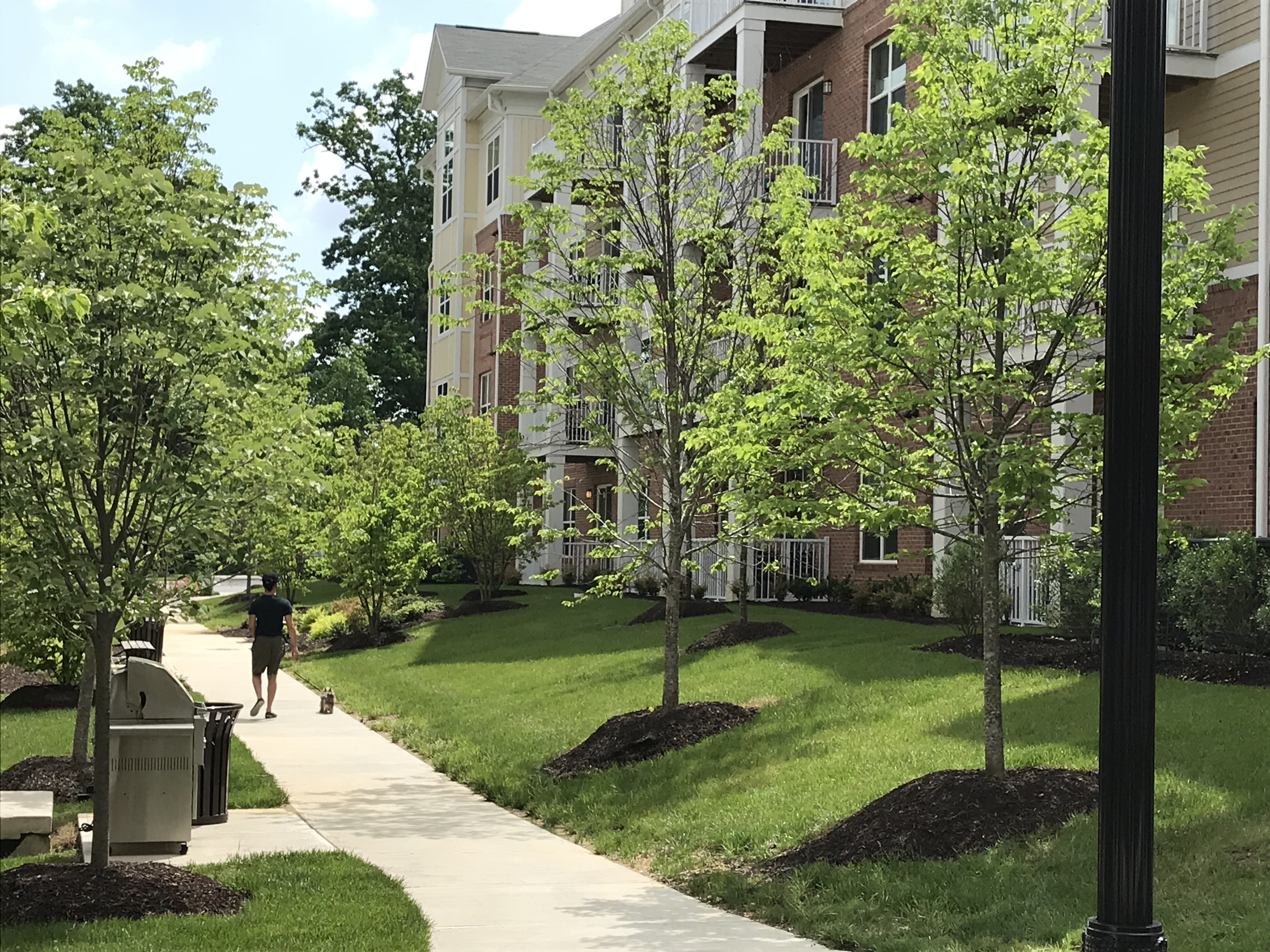
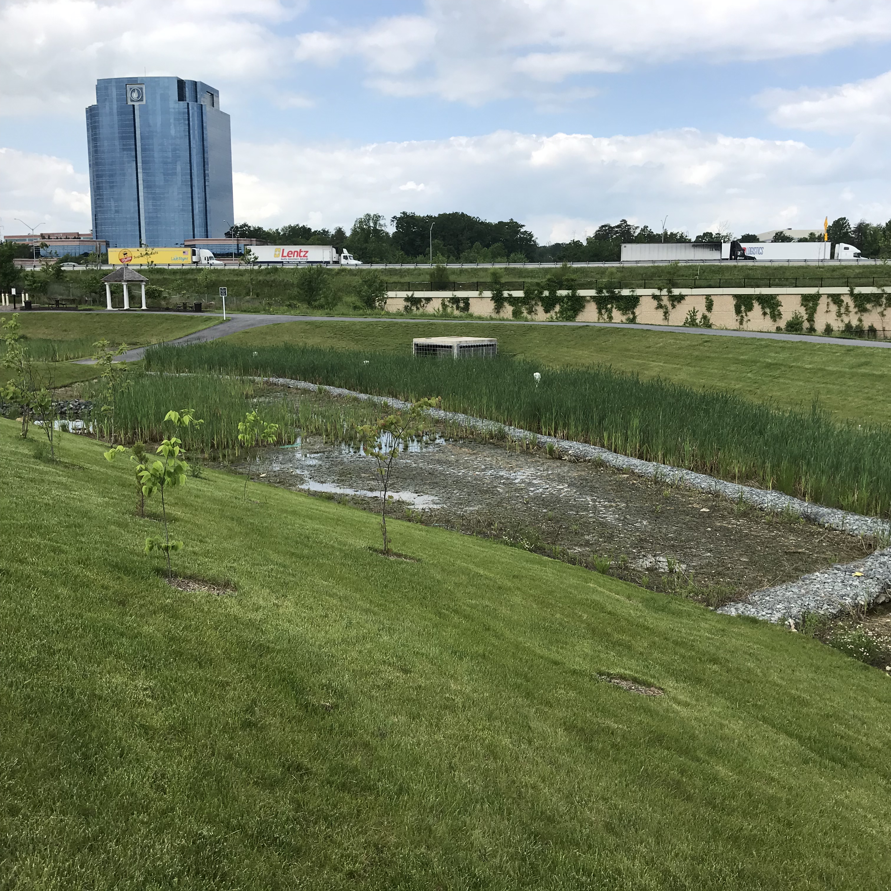
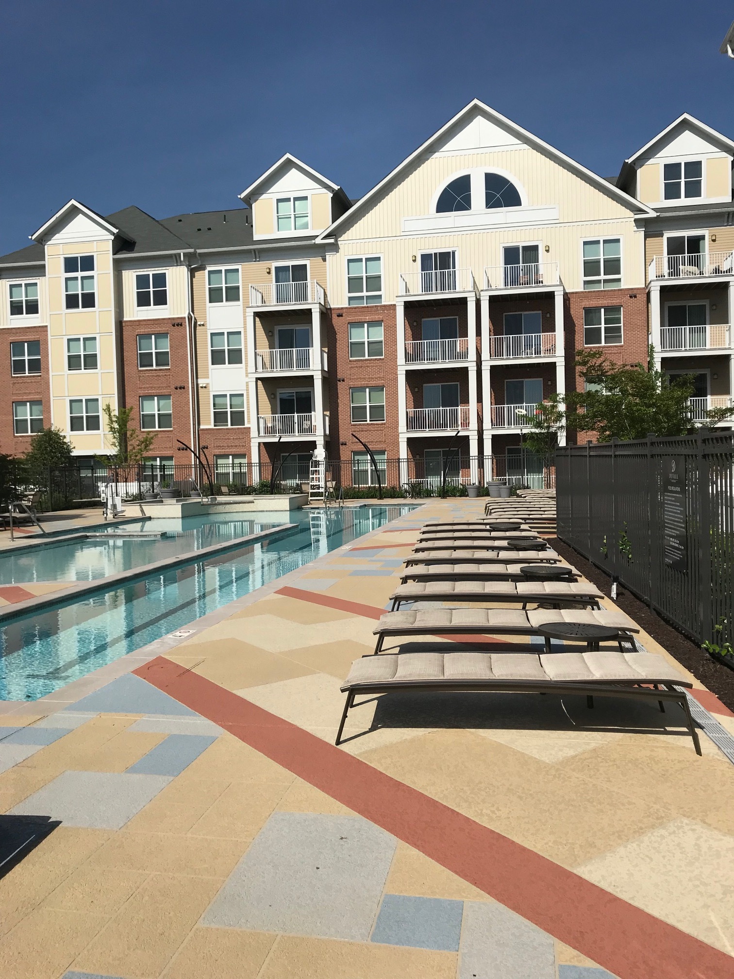
Shipley’s Grant is a mixed-use development located adjacent to major highways; MD Route 100, Snowden River Parkway, and Waterloo Road (MD Route 108).  The site was developed as a multi-phase, Traditional Neighborhood Design (TND zone) townhouse community with a 3.4-acre shopping center and two recreation/community centers.  Challenges for GLW planners and engineers included traffic noise from vehicles on Route 100, a stream and associated buffers that run through the center of the property, sensitive preservation of the exiting farm house and cemetery, and extensive  road improvements required for Waterloo Road and Snowden River Parkway.

The Solution

GLW’s role was brought in to provide environmental, engineering, surveying and landscape design services from the initial planning stage through construction phases.  The property was planned as a high density development that required careful site design and engineering to ensure the closely connected neighborhoods could be coordinated and constructed in overlapping phases required for the various builders and market demands.

During the entitlement process, GLW assisted in two separate rezoning petitions and construction permits which were obtained from multiple agencies including Howard County, Maryland State Highway Administration, and Maryland Department of the Environment.  During the 15-year lifespan of the project, GLW was able to successfully adapt the overall plan as market conditions dictated, allowing our client/developer flexibility to change land uses and multiple builder and unit types. These changes were navigated through the regulatory agencies with no negative impacts to our client’s original vision for the project.

Olney Town Center

Olney Town Center 06

Project Description

Client/Builder/Developer:  Carl Freeman Retail
LocationOlney, Montgomery County, MD
Market: Retail – Shopping Center
Size: 12.96 acres
Zoning: M-X-T
Density0.19 Floor Area Ratio, 109,924 Square Feet retail

Recent Projects

The Challenges

Olney Town Center was a redevelopment of a declining commercial shopping center with vacant stores and outdated architecture. A complete renovation of the center’s architecture, vehicular and pedestrian circulation and tenant mix was needed for our client to achieve a successful turnaround.  Additionally, as recommended by the Olney Master Plan an area had to be set aside for a community gathering space.

The Solution

GLW planners first obtained a parking waiver to take advantage of differences in parking demand based on various uses within the center. This allowed a more sustainable, marketable retail square footage that ultimately improved the tenant mix.

A driveway was constructed in coordination with an adjacent shopping center to provide inter-connectivity as a solution to mitigate traffic on adjacent public roads.

The center’s redesign incorporated Americans with Disabilities Act (ADA) requirements for a center that was built before the ADA law, and was not fully compliant.  This led to walkway design solutions including using landscape planters to separate accessible from non-accessible sidewalks. Ultimately, the center was brought into full ADA compliance.

GLW designed a community gathering place by adding special paving, site furniture, outdoor dining and public fountain. This space has become a community gathering node over the years including band concerts and art sales.

GLW, provided engineering, surveying and landscape architecture and worked on a team that included a well known local artist and architect to conceptually design the building façade and community gathering places that reflect the agricultural history of Olney.  As a result, Olney Town Center is a thriving retail asset which incorporates a variety of restaurants and retail services as well as a community node that is popular with shoppers especially during the summer months.

GLW also solved a long term flood mapping issue by removing the property from FEMA flood maps, through FEMA Letter of Map Revisions (LOMR) when it was previously a stream valley.

Archstone Kentland’s Village

Archstone-Kentlands-01

Project Description

Client/Builder/Developer:  Archstone Communities
LocationGaithersburg, Montgomery County MD
Market: Multi-family
Size: 5.85 acres
Zoning: MXD
Density52 DU/AC, 307 units, 13,193 SF retail

Recent Projects

The Challenges

GLW was brought in to provide engineering and surveying services to redevelop a big box retail site in the City of Gaithersburg into a “Texas doughnut style”  up-scale multi-family residential building with first floor retail surrounding a multi-story above-ground shared parking structure. The existing site was an expanse of open asphalt that did not fit well with the surrounding Kentlands planned community.  City of Gaithersburg required design guidelines that resulted in Kentlands being a walkable community with traditional architecture and features such as porches close to the street, narrow, pedestrian-oriented tree-lined boulevards, and sidewalks constructed with special pavers rather than concrete.  Narrow street widths challenged engineers to meet fire safety requirements and design utilities, easements and rights-of-way within a limited area.

The Solution

The architects of the multi-family building design created open archways through the building which provided the opportunity to design an efficient and cost-saving main trunk sewer through rather than around the building.  GLW engineers worked closely with WSSC personnel to satisfy vertical clearance necessary in the archways to allow for maintenance of the sewer.

Through careful planning and detailed coordination with various design professionals meeting fire truck circulation and multiple utility service requirements within narrow streets was accomplished.

The project’s second phase included extending the Kentlands’ style boulevard through to a redevelopment of a restaurant pad site into an office building incorporating the same architectural treatment style.

Modera Westside

MAIN_MODERA WESTSIDE

Project Description

Client/Builder/Developer:  Mill Creek Residential
LocationWestside Boulevard, Laurel, Maryland
Market: Multi-family
Size26.80 Acres
Zoning: M-X-T
Density18 DU/Acre

Recent Projects

The Challenge

The Modera Westside multi-family development is part of a larger 56.63 acre mixed-use development that also includes townhouses, hotel and a retail center.  The property, which enjoys a prime location minutes from I-95 and adjacent to the future Konterra mixed use town center, was annexed into the City of Laurel in 2012. The project is built on reclaimed land that had been previously mined for sand and gravel. An existing stream and two major water lines define the boundaries on two sides of the property.  A large sediment control pond needed for the mining operation had to be converted to a sediment control pond then stormwater management pond for the multi-family development. Before the apartments could be constructed, GLW designed a 1,700’ long public street which had to be built and dedicated to the City of Laurel to provide access to the land-locked multi-family property.  

The Solution

GLW provided full entitlement processing services from rezoning to site plan approval.  Site grading and engineering focused on designing a submerged gravel wetland in the stormwater management pond that could handle both water quality and 100 year flooding events for most of the larger 56 acre property.  A single sanitary sewer location required all site grading and sewer design to accommodate future on-site development. To allow construction of the apartments over the former sand and gravel mine, GLW provided detailed settlement monitoring of soil compaction during the backfilling operation.  The entrance road was designed and located to allow for a large berm and landscaping to buffer views of the development from the adjacent residential neighborhood.

Steeplechase

02 multi tenant

Project Description

Client/Builder/Developer:  Atapco Ritchie Interchange, Inc.
LocationRitchie Marlboro Road, Prince George’s County, Maryland
MarketIndustrial
Size110.26 Acres
Zoning: I-1, Light Industrial, Retail
Density:  N/A

Recent Projects

The Challenge

Steeplechase is a 110-acre mixed-use (flex-office/warehouse and retail) development located on the Capital Beltway at the Ritchie Marlboro interchange. Prince George’s County awarded Steeplechase a Foreign Trade Zone status because of its excellent visibility along I-495 and because it offers 28 individual retail spaces of 50,000 to 500,000 square feet. Initial plan approvals permitted a retail component in the Industrial Zone provided that 10 retail parcels would be subject to Site Plan approval by the Planning Board. This would ensure design compatibility in architecture, building materials, signage, entry walls and landscaping between the various retail uses. The remaining industrial/warehouse parcels have owners/tenants with their own needs and specifications. The parcels are located around a stream and associated wooded areas, floodplains, steep slopes and wetlands.

The Solution

GLW was responsible for site planning, landscape architecture, civil engineering (site layout, site grading, storm drain/SWM design) and construction permitting for each of the parcels. Design requirements ranged from siting massive power requirements for a medical cannabis grower to stormwater storage in large underground pipes to allow siting our client’s building. On another parcel, GLW recommended a wetland consultant review an outdated wetland delineation. The updated wetland allowed for an improved site design that protected wetlands and increased the development envelope for our client. Throughout the development, parking areas and buildings were located to avoid sensitive environmental features and minimize the amount of earth moving required.

Westphalia Row

05 Phase 1 playground parcel G (1)

Project Description

Client/Builder/Developer:  Haverford Homes, Inc.
LocationRitchie Marlboro Road, Upper Marlboro, Prince George’s County, MD 20772
Market: Mixed Use – Townhouse and retail
Size20.67 Acres
Zoning: M-X-T
Density0.61 Floor Area Ratio overall, 275 townhouses, 10,000 Square Feet retail

Recent Projects

The Challenges

Westphalia Row is a GLW designed mixed-use residential and retail development that is located near the Capital Beltway and Ritchie Marlboro Road. Important design considerations were to reduce vehicular noise from the Beltway and a nearby exit ramp, provide road improvements along the adjacent Sansbury Road, maximize retail and housing density by adjusting the existing Fernwood Drive, and address “Gateway Entrance” requirements of the Westphalia Sector Plan. Further, our client wanted to develop the project in three phases to allow townhouse sales to stay even with land development construction.

The Solution

GLW provided planning, landscape architecture, engineering and surveying services throughout the entitlement, permit and construction processes.  The project layout is a high density, compact, urban design with a centrally located recreation center and numerous landscaped activity areas interconnected by sidewalks throughout the development.  A safe and efficient realignment of Fernwood Drive through the center of the property provided greater flexibility to lay out the residential, recreational and commercial blocks. Along the common property line to the Capital Beltway exit ramp a concrete noise wall was designed and constructed.  The noise wall was designed to look like brick and extensive landscaping was used to reduce the impact of the wall seen by homeowners and motorists. A special gateway sign and landscaping was designed to announce entry into the Westphalia Town Center area and to compliment the Westphalia Row project.

GLW created added value to the project by proposing to use an adjacent off-site surplus property owned by Maryland State Highway for a stormwater management pond.  A negotiated land swap between our client, an adjacent property owner and the Maryland State Highway Administration allowed a stormwater management pond to be built off-site but adjacent to the property resulting in a higher unit yield.  

Bowie Marketplace

11 retail

Project Description

Client/Builder/Developer:  Berman Enterprises
Location3206 Superior Lane, Bowie, Prince George’s County, Maryland 20715
Market: Mixed Use – Retail Shopping Center & Multi-family Apartments
Size20.29 Acres
Zoning: C-S-C
Density0.47 Floor Area Ratio, 275 multi-family units, 134,992 Square Feet of retail

Recent Projects

The Challenge

Bowie Marketplace was a redevelopment of a nearly vacant indoor mall. Situated in a highly visible location on a major arterial road, both residents and officials from the City of Bowie wanted the mall repurposed or torn down. The City of Bowie was an active proponent in bringing a development team together to create a new vision for the property. GLW was charged with providing design and construction services that would ultimately combine retail stores alongside residential apartments.

The Solution

Through a public-private partnership with the City of Bowie the mall was torn down and replaced with a phased mixed use development that included retail and residential components.  GLW provided planning and engineering services on the first phase, which was a 100,050 sf shopping center constructed on the northern portion of the property in 2016. Numerous outparcels located along Annapolis Road (MD Rte. 450) take advantage of high visibility by motorists.

The second phase will be a 3-4 story, 225 unit, apartment building built on the southern portion of the property behind the shopping center. The shopping center was designed with a driveway running through the middle of the parking lot between the stores and terminating at the future entrance of the apartment building.  GLW designed living walls and planters and easy pedestrian access between the two uses allowing them to coexist and complement each other. The apartment building is served by a multi-story parking garage and site amenities that include a pool, paved activity and sitting areas and landscaping.

Shelbourne Senior Living of Olney

Main Shelbourne Senior Living Olney

Project Description

Client/Builder/Developer:   Formation Development Group, LLC
LocationOlney, Montgomery County, MD
Market: Senior Living
Size4.96 acres
Zoning: RE-2/TDR – Special Exception
Density1 Bed per 1,200 SF / 174 Beds

Awards:
Leed Certification

Recent Projects

The Challenge

Shelbourne-Olney is a Senior Assisted Living Facility with one floor devoted specially for the care of Alzheimer’s patients.  The property was almost entirely forested with many large, mature trees and a vital stream and associated floodplain/buffer. The property lies within the Hawing River Watershed which required special treatment because it flows directly into the Patuxent River Watershed.  An important goal of the development was to preserve the existing mature forest, specimen trees, and stream buffers while providing a quiet, wooded setting appropriate for seniors, particularly the Alzheimer’s patients. Additionally, our client wanted LEED® certification for the project which required high standards of environmental conservation and green construction.

The Solution

Site grading, buildings, driveways, and stormwater management facilities were designed to avoid impacting surrounding specimen trees, wetland and stream valley buffers.   The entrance road alignment and grading saved two massive trees, a White Oak and Ash, which served to screen the building from nearby road traffic and to emphasize the forest setting.  The rear of the building faced a mature forest requiring a retaining wall up to 13’ high to create a terrace for an Alzheimer’s garden with a wide open view out over the wall. The garden was planted with distinctive, colorful plants intended to stimulate the mind and create a memorable experience.

To gain LEED® certification the structure was built with a green roof that covers more than 50% of the roof area. The green roof was designed with a rubber membrane below a soil layer planted with succulent plants that are able to retain water in especially dry conditions.   All downspout and parking lot runoff is piped to bio-retention facilities so that no net additional untreated drainage leaves the developed area. A path runs around the building along the woodland edge and past ornamental landscaped areas provides an attractive route for seniors to exercise.  Other stormwater facilities including grass channels, sand filters and micro-bioretention ponds were located and landscaped to minimize their visual impact.

Brightview Senior Living – Rockville

Main Image_Brightview

Project Description

Client/Builder/Developer:  Shelter Group
Location9200 Darnestown Rd., Rockville, MD 20850
Market: Senior Living
Size3.69 Acres
Zoning: R-90, Special Exception
Density:  N/A

Awards:
Leed certification
MBIA Environmental Award, Category:  Land Development

Recent Projects

The Challenge

Brightview at Rockville is a senior Assisted Living Facility specializing in the care of Alzheimer’s patients.  The current zoning is R-90 which is a residential zone that allows a special exception (subject to specific minimum requirements) for housing for senior adults or persons with disabilities.  Challenges centered around saving existing mature trees and designing for new environmentally sensitive stormwater management design requirements.

The Solution

From the outset GLW identified an existing double row of mature white pine trees located on the western and southern property lines and a majestic, mature 45” dbh American Elm tree located at the center of the property.  Careful site grading allowed the elm tree to not only be saved but become a focal point around which the building, parking and seating area were sited. The existing double row of mature pines and other existing mature vegetation was saved to buffer the proposed building from the surrounding neighbors while providing a quiet, secure sense of place that is appropriate for seniors, particularly Alzheimer’s patients.  Remarkably, 105 of the 160 mature trees which existed on site were retained.

At the time, new stormwater management regulations were met using innovative environmentally sensitive design that utilized many small bio-retention facilities scattered around the property and landscaped with ornamental wetland plants.  All roof and parking lot runoff was piped to the bio-retention facilities or dry-wells for no net additional untreated drainage leaving the developed area. Parking spaces and sidewalk around the building was constructed using permeable pavement allowing rainwater to drain directly into the soil rather than having to be collected and managed in a stormwater facility.  Additionally, a garden/seating area was designed for Alzheimer’s patients with distinctive, colorful plants and flowers intended to stimulate the mind and create a memorable experience for residents.

Trotters Glen

20180601_151449

Project Description

Client/Builder/Developer:   Toll Brothers
LocationBatchellors Forest Road, Olney, Montgomery County, Maryland
MarketResidential – Single-Family Detached
Size175.80 acres
Zoning: RNC – Optional Method with MPDU Density Bonus
Density:  69 half acre lots (avg.), including (1) 15 acre farm lot

Recent Projects

The Challenges

This project was a redevelopment of an 18 hole golf course into a cluster subdivision of 68 half-acre lots.  The property, located along a designated “rustic road” required special treatment to maintain its rural character.  A large pond that served as a golf course hazard became a liability when developing a single-family neighborhood. Detailed analysis of existing grades early in the process revealed the need for grinder pumps for a group of houses on a cul-de-sac.

The property owner wanted to continue living in her home on the property that included horses, barns, fenced areas and outbuildings.

The Solution

GLW provided planning, landscape architecture and engineering services to cluster private lots around a 15-acre lot set aside for the owner. This allowed vegetative screening of the existing home and outbuildings and provided large areas of homeowner-owned open space to create privacy and passive recreational opportunities for residents.  The existing pond was evaluated and restored to its former condition as a stream. The stream became an amenity for homeowners, visible from existing golf cart paths and bridges that were repurposed along with new paths that connect to a public hiker/biker trail.  The paths took advantage of other existing environmental features such as scenic overlooks, specimen trees and undulating terrain. Additionally, a centrally located “village commons” provided seating areas and informal recreational space. Creative use of the roadside ditches for stormwater bio-swales resulted in a reduction of storm drain piping and elimination of large stormwater ponds.