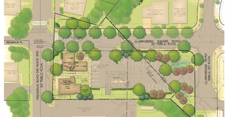
Preserve at Piscataway Recreation Center and Hiker/Biker Trail

PISCATAWAY-01

Project Description

Client/Builder/Developer:  Woodlawn Development Group
Location:  Accokeek, Maryland
Market: Recreation, Residential
Size: 858.7 Acres
Zoning: R-L, L-A-C

Recent Projects

The Challenges

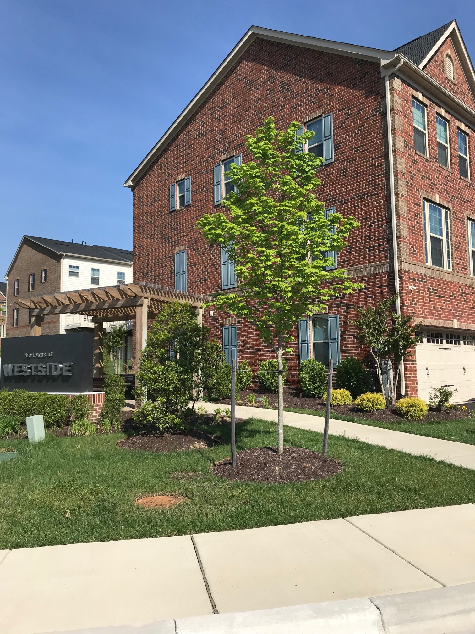
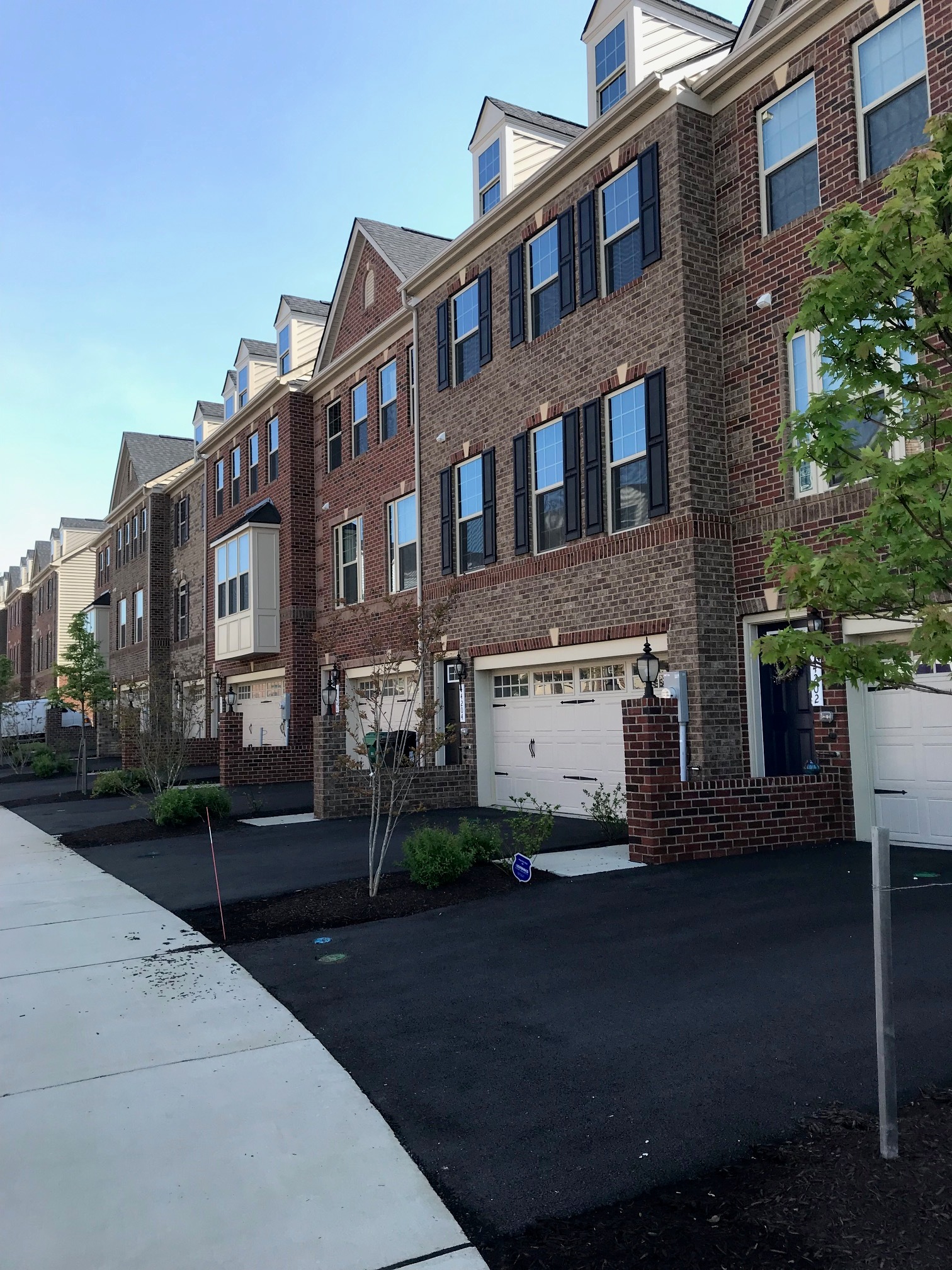
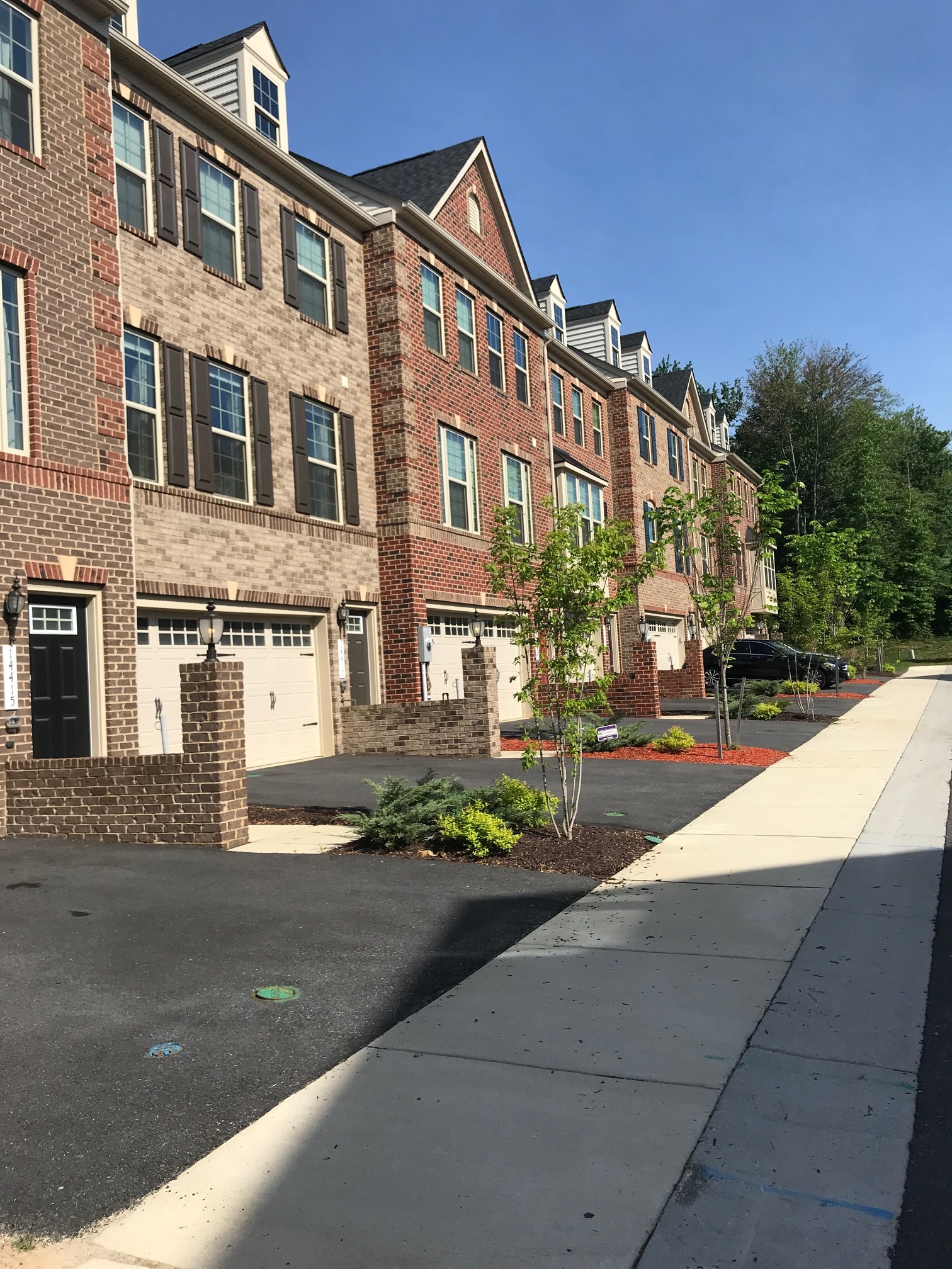
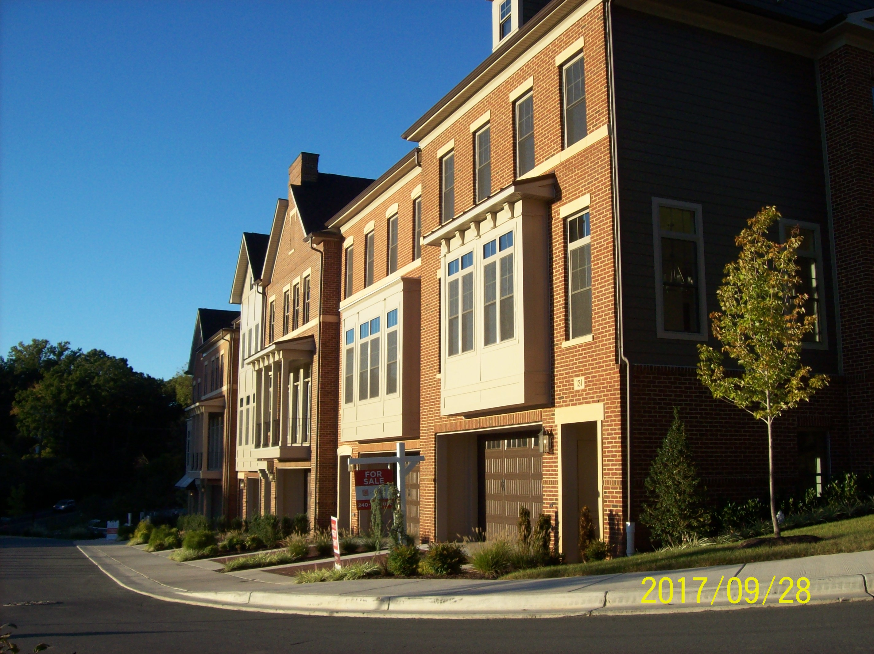
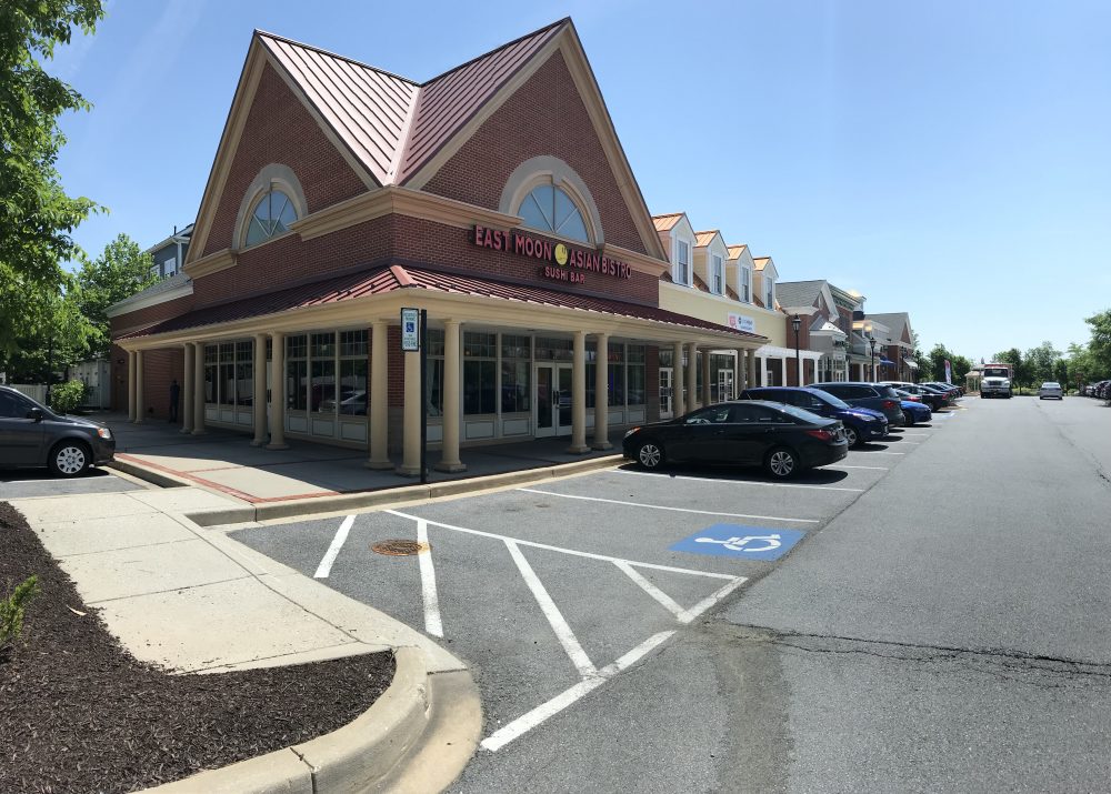
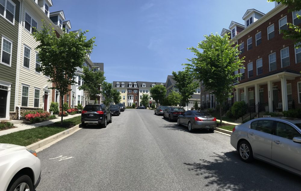
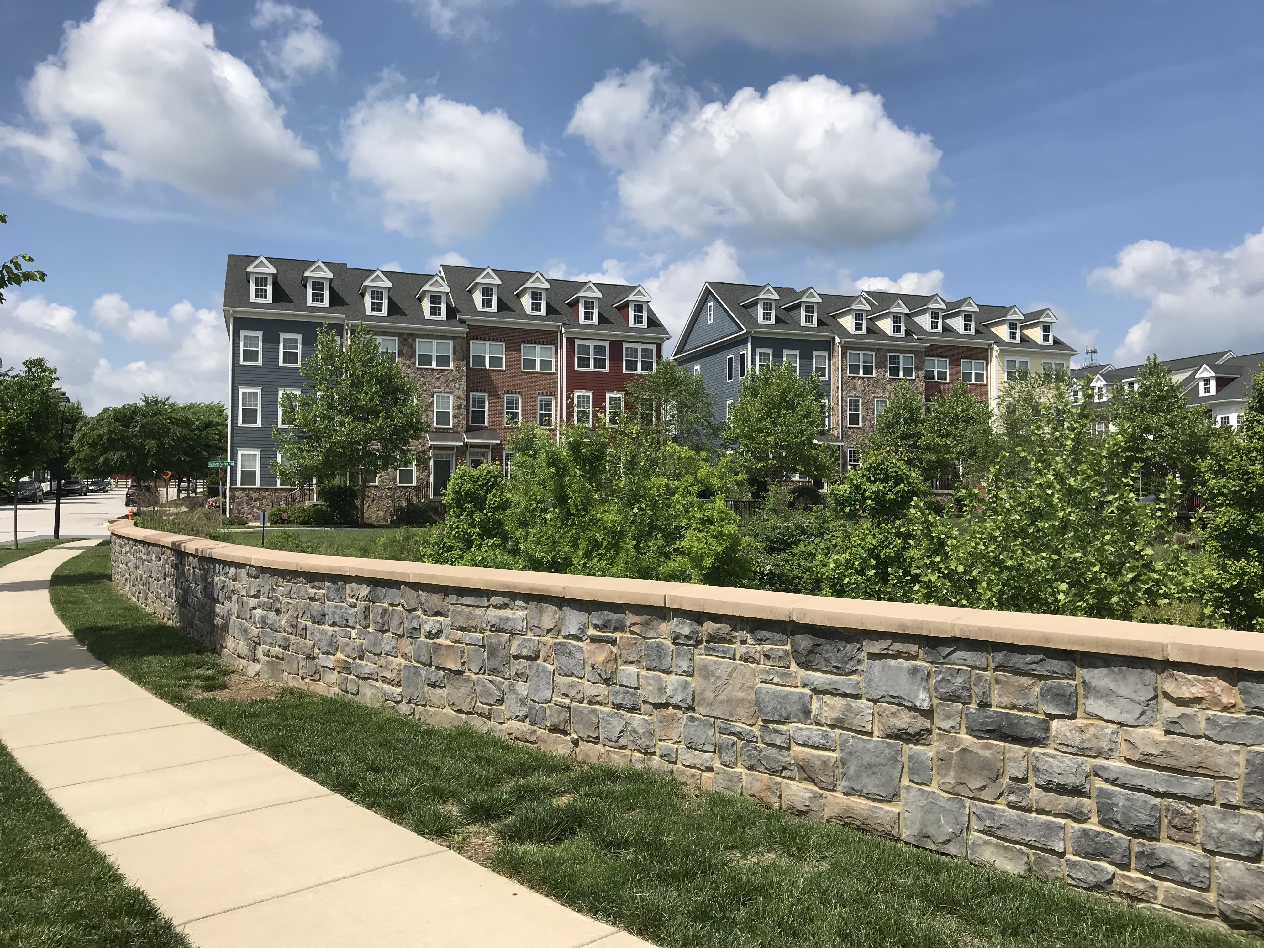
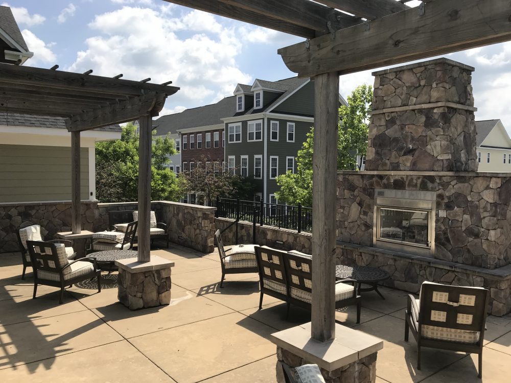
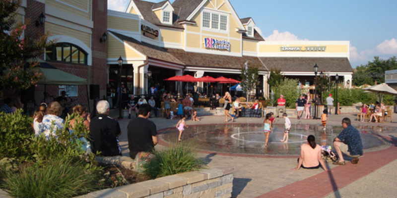
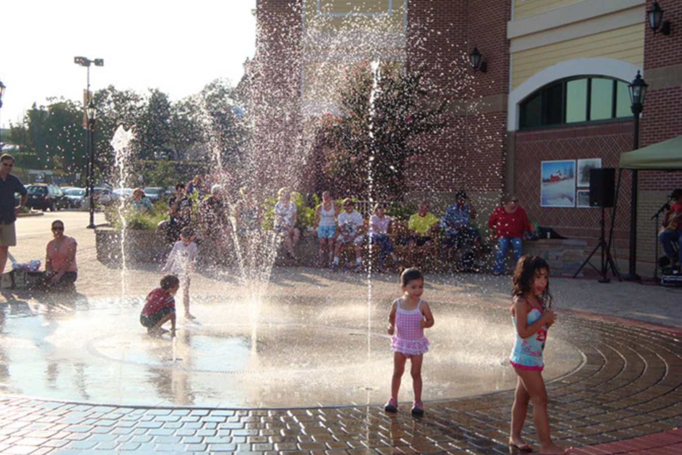
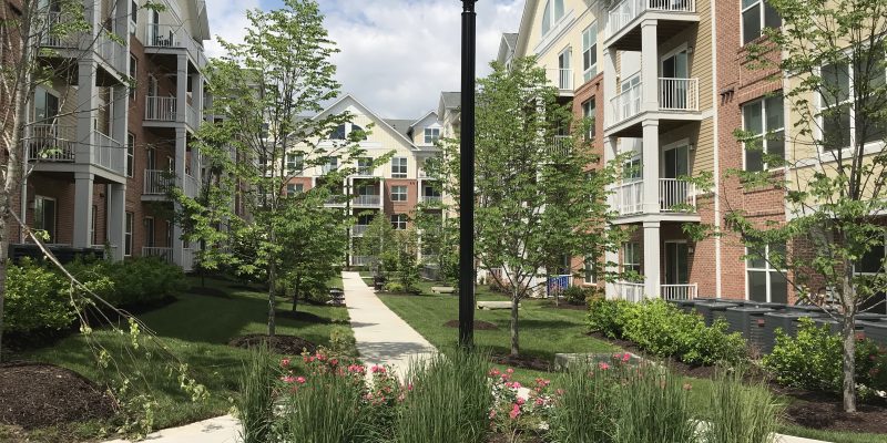
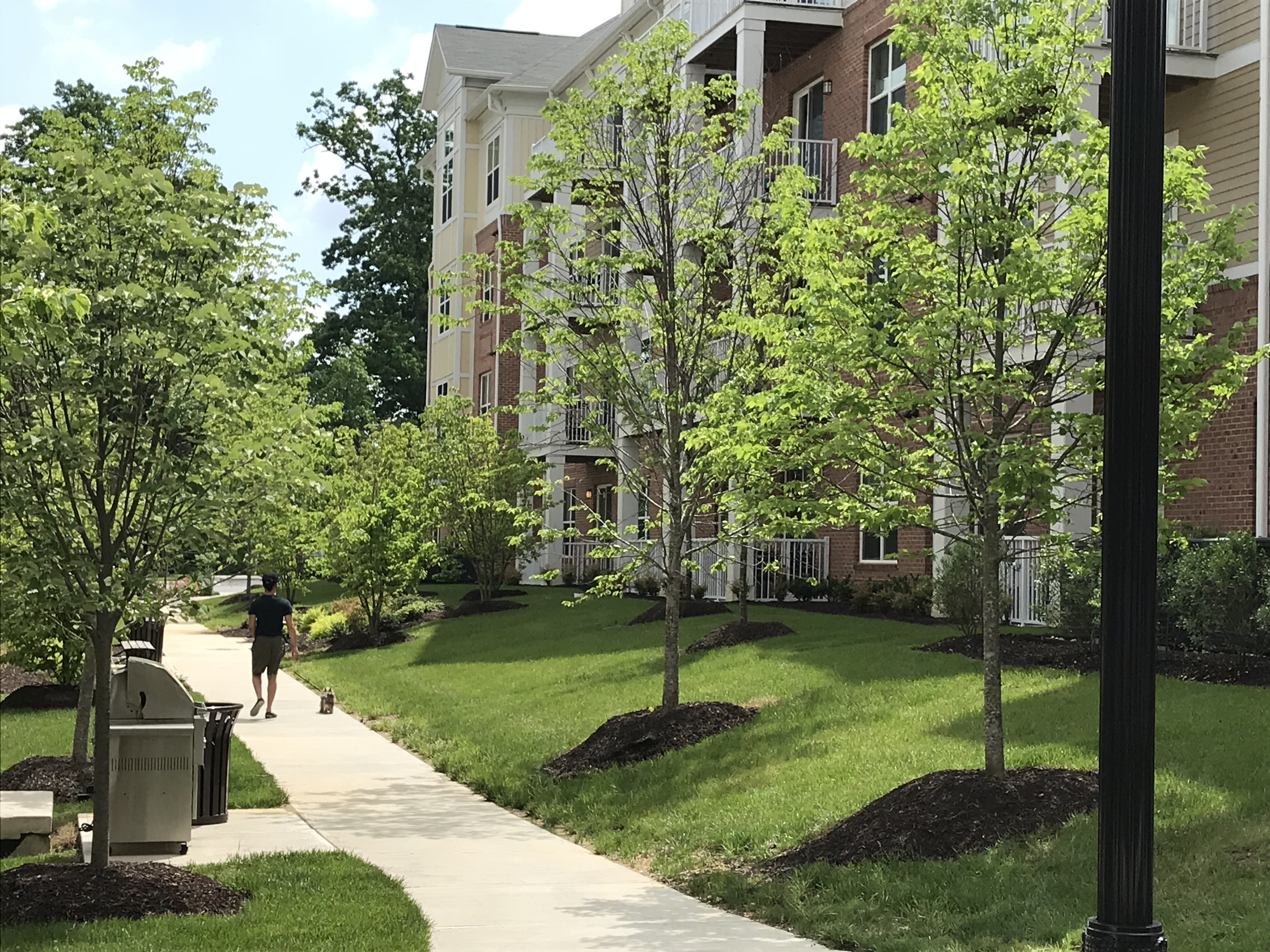
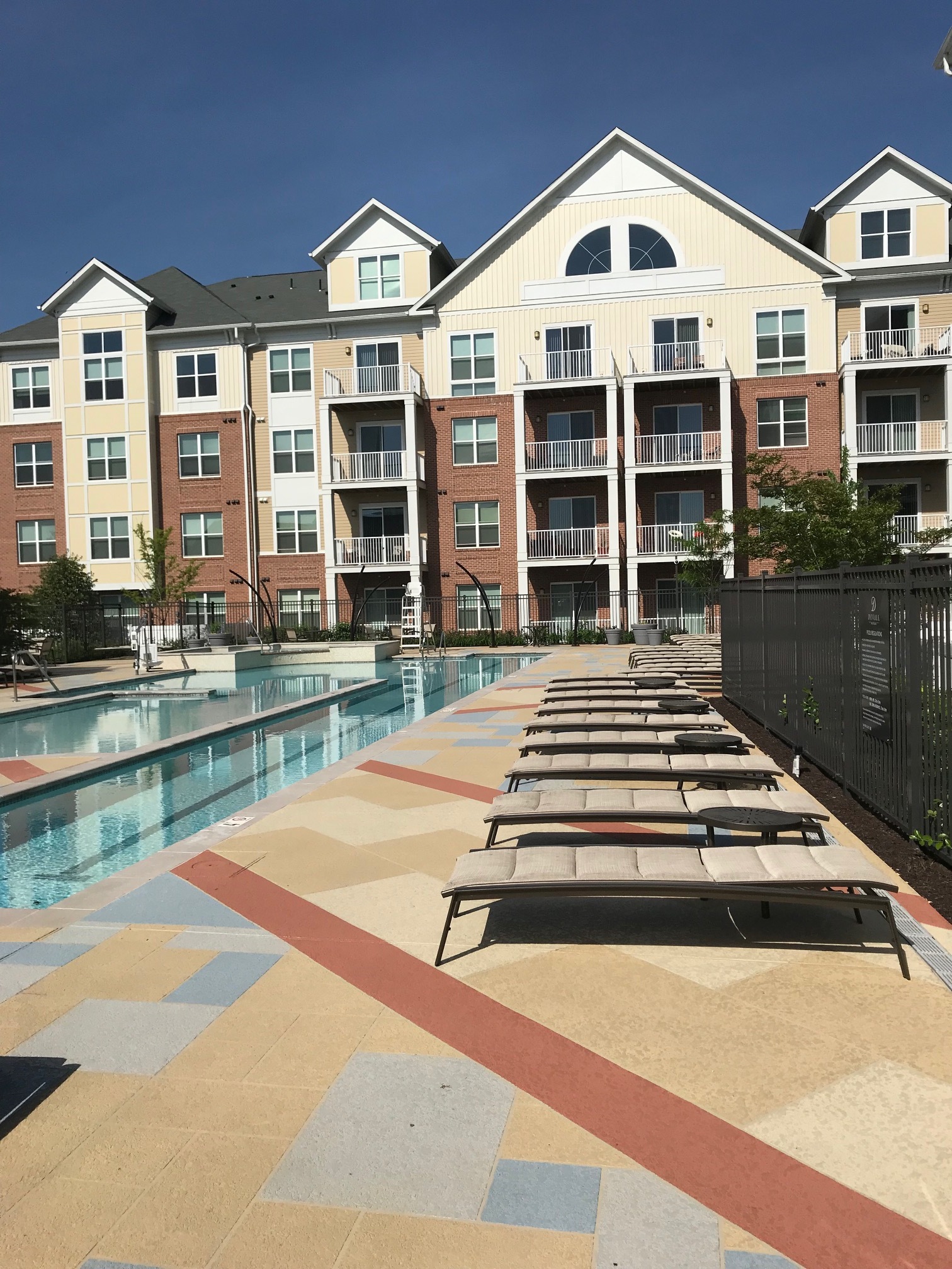
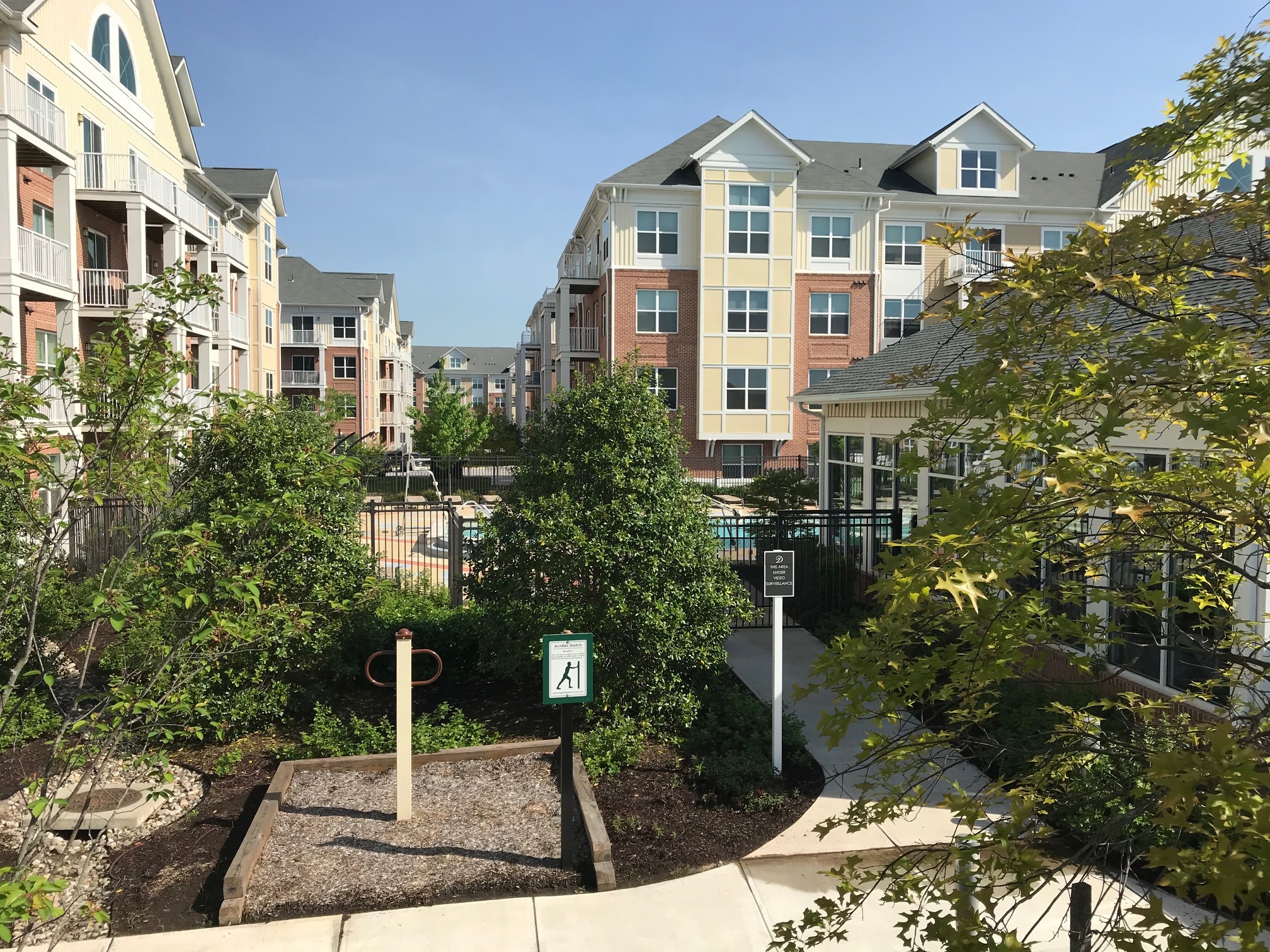
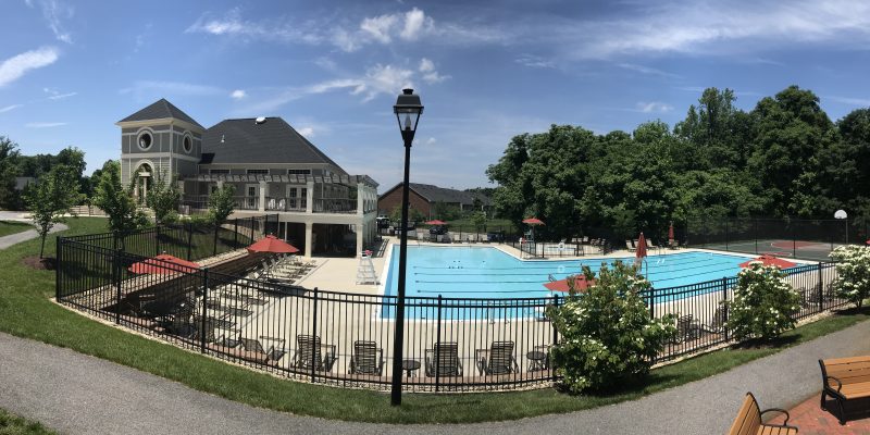
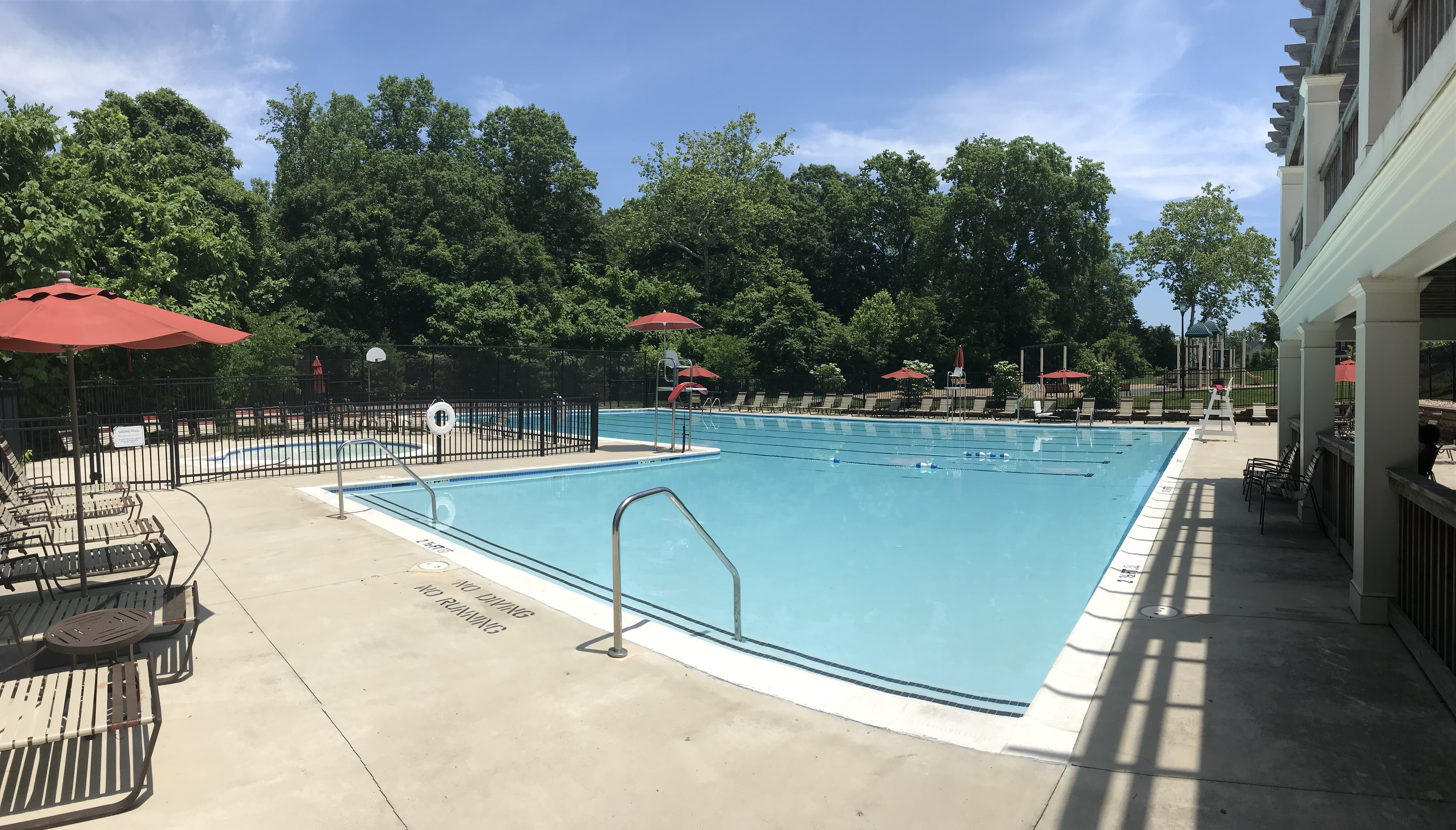
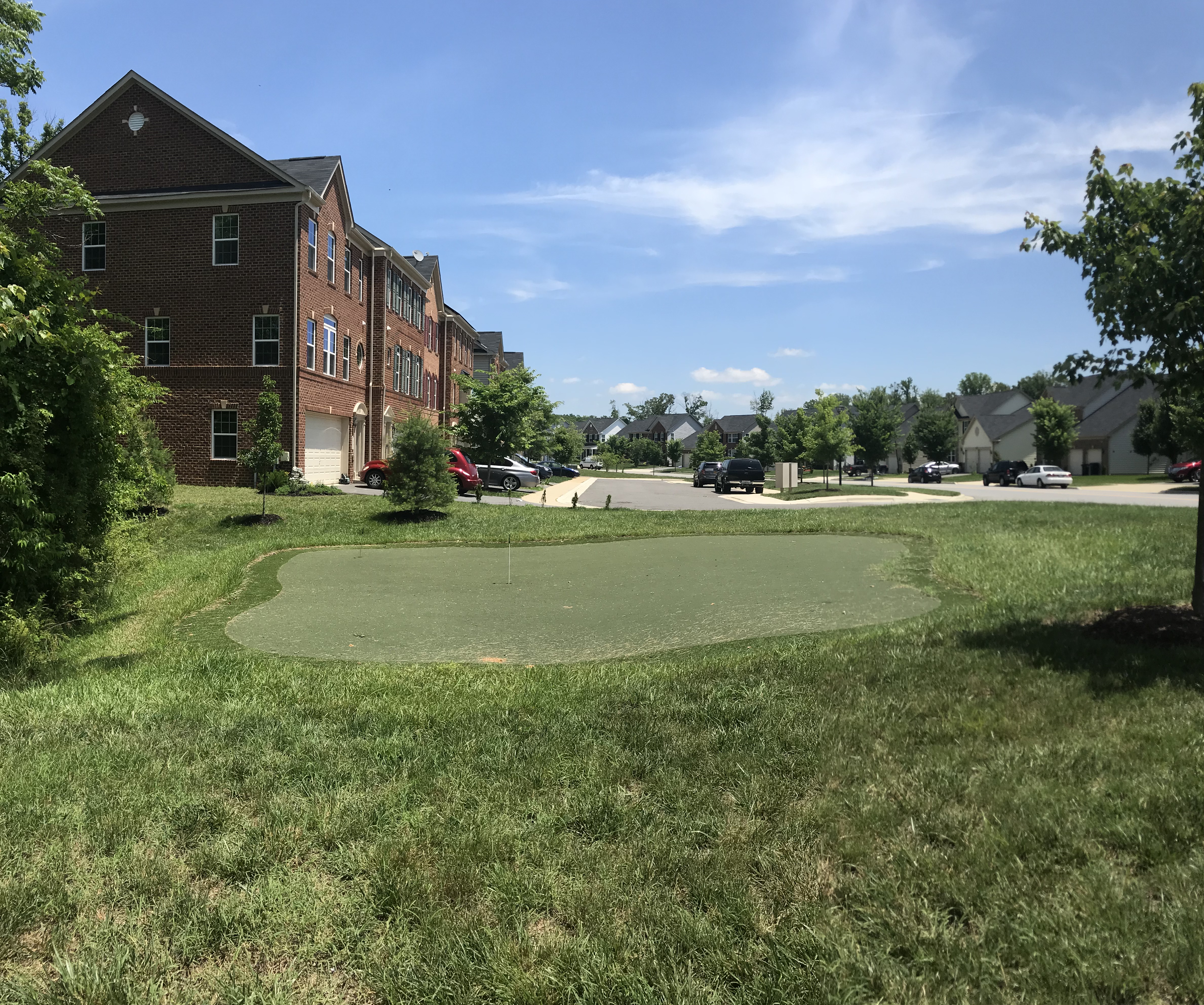
The Preserve at Piscataway is a 1,000+ home residential community with extensive private recreation facilities.  The development consists of five separate villages placed strategically on what were once forested ridges and open fields of the former Bailey Plantation.  GLW was brought in to resurrect the development after a major downturn in the housing market due to the economic recession of the mid-2000’s.  Two of the five villages had been designed and mostly constructed and GLW was tasked with providing design, engineering, surveying and permitting services to complete the development including the recreation facilities.  GLW amended the approved Site Plan to remove a proposed golf course which was no longer a viable enterprise.  A main goal was to provide both active and passive recreational opportunities for the residents of all ages utilizing the vast open space, a putting green, a hiker/biker trail and other facilities were offered as a substitute.  These amenities were a major part of the successful marketing of new homes to be built in the community.


The Solution

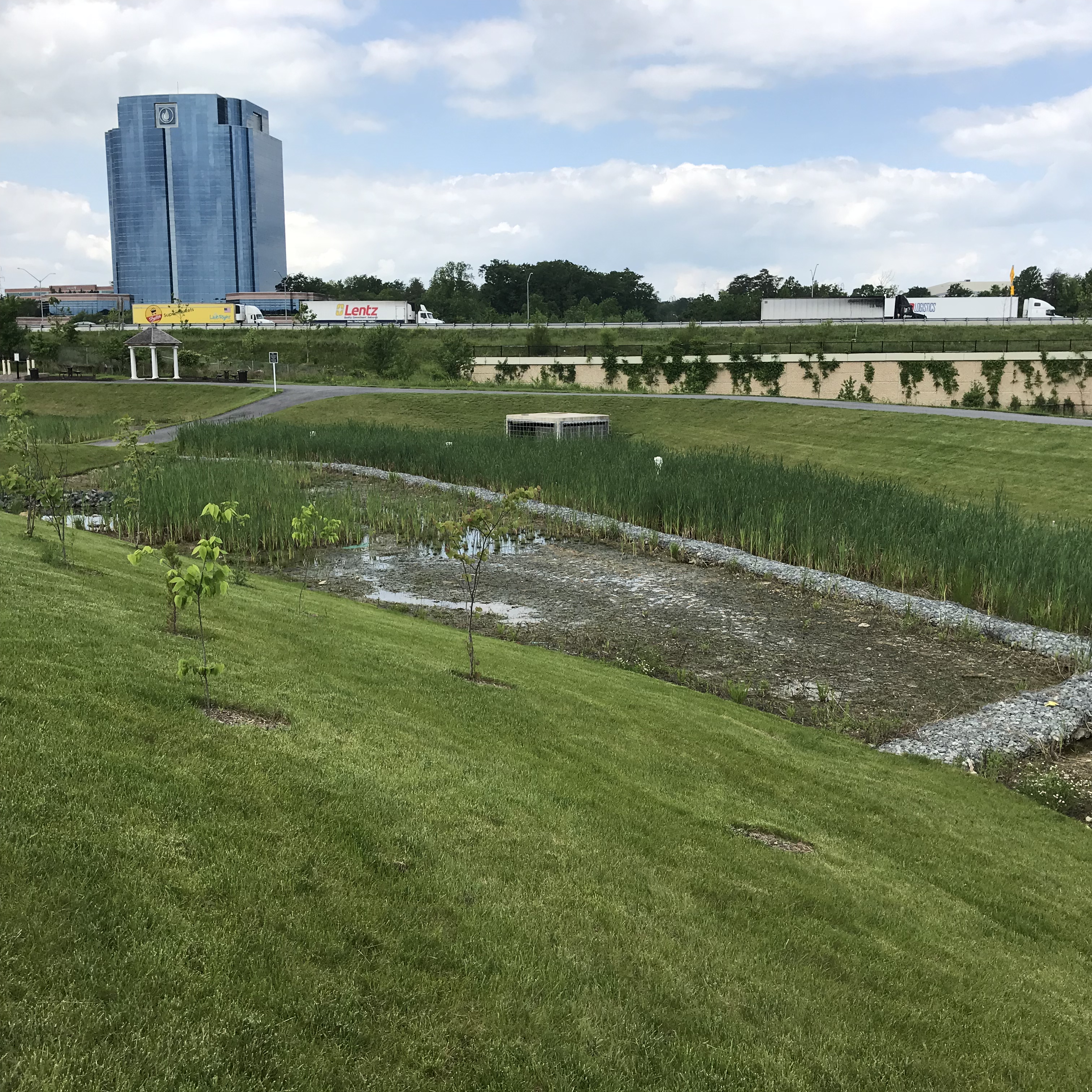
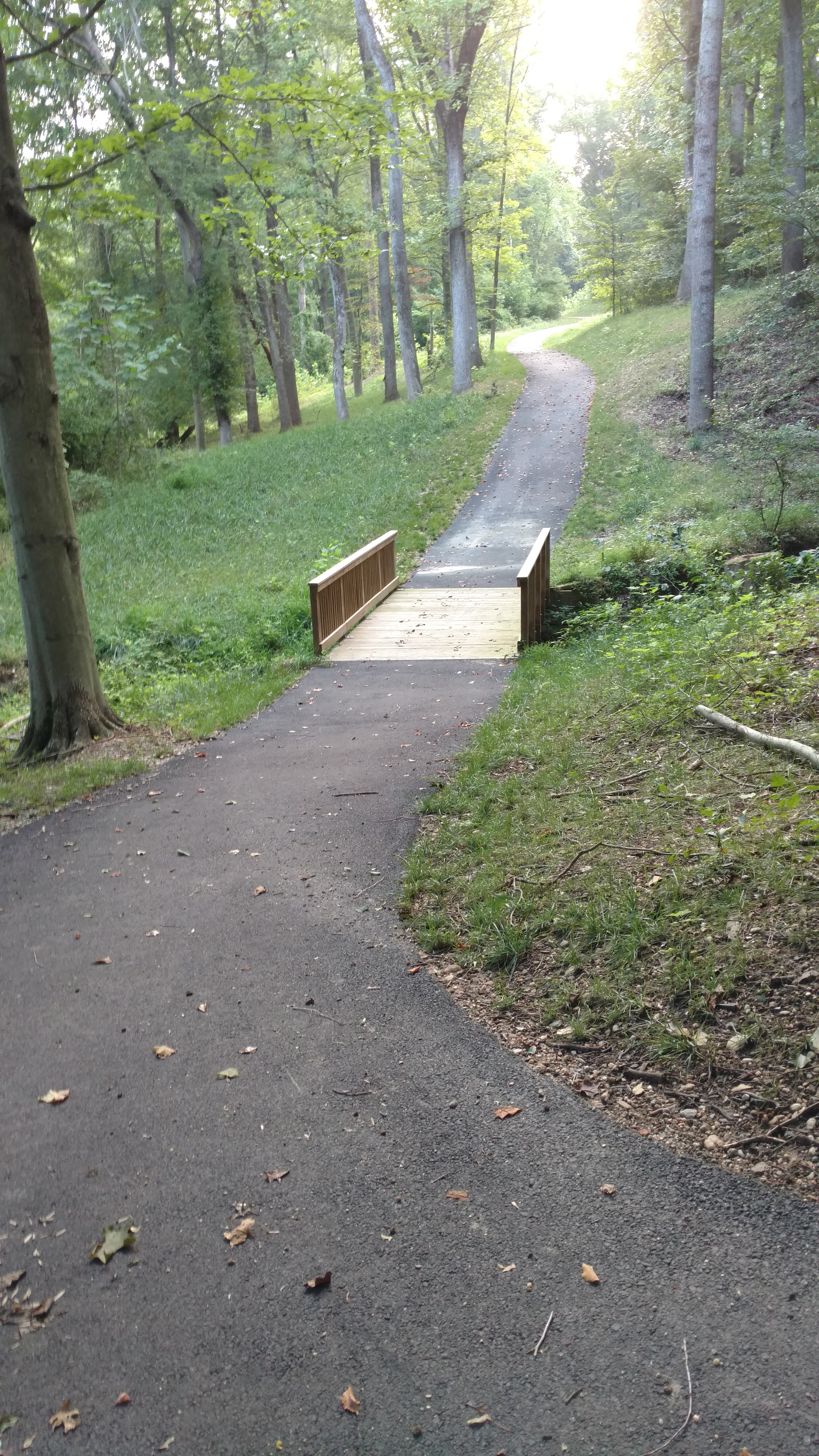
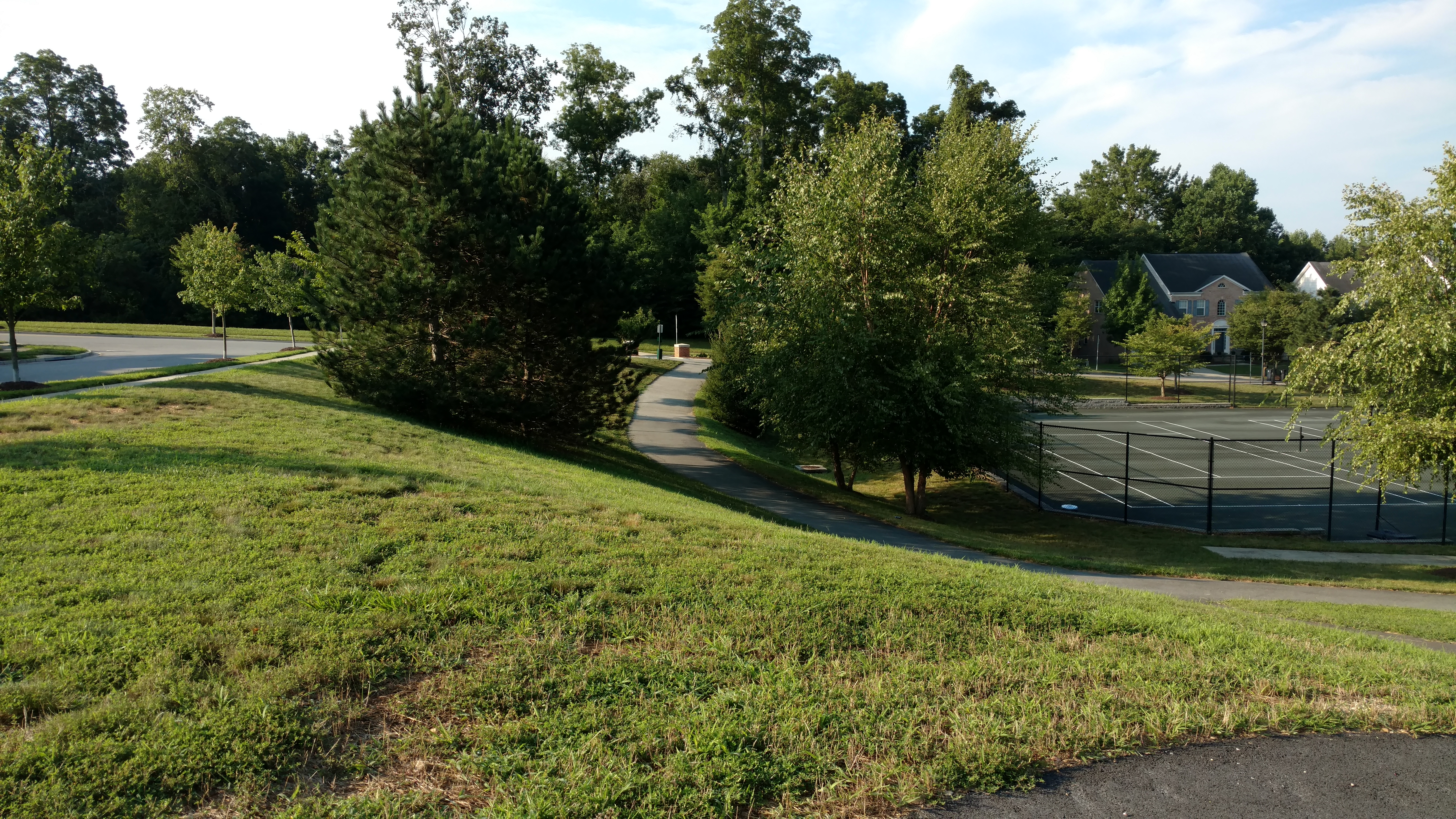
GLW provided landscape architecture and engineering services for the recreation center and an extensive pedestrian system that weaved through open space and connected the villages via sidewalks and nature trails.  The hiker/biker trail is 2.2 miles long and was designed to minimize impacts to environmental features such as specimen trees, steep slopes, mature forest and streams.  Scenic vista points, sitting areas, open canopy forest, and village connectivity are features made available to residents while still being sensitive to their concerns such as privacy and noise.  At the resident’s request, GLW revised the recreation center to construct a picnic area and shelter in place of the basketball court and to add a putting green and a large, open, multi-purpose play area for active recreation.


Royal Farms – Anderson’s Corners

IMG_2891_CROP

Project Description

Client/Builder/Developer:  Royal Farms
LocationLaurel, Maryland
Market: Commercial/Retail
Size: 2.03 acres
Zoning: M-X-T (Mixed Use – Transportation) – Special Exception
Density: 0.06 FAR

Recent Projects

The Challenges

Royal Farms builds and manages over 150 convenience/gas stores throughout the Mid-Atlantic region.  Royal Farms – Anderson’s Corners is located in a developing area in west Laurel off I-95 adjacent to over 900 newly constructed apartments, townhouses and the proposed Konterra Town Center with over 2,000 homes, hotels and over 2 million square feet of commercial, entertainment and office uses.  Providing gas service to customers required special pollution prevention measures to capture any accidental fuel spills.  The project location required development plans to be reviewed and permitted by multiple city, county, state  agencies that often conflicted with each other.  The site had significant grade change from front to back and consisted of mostly wet, non-compactable soils.

The Solution

GLW was tasked with providing planning, engineering, landscaping and forest conservation services for the project.  Our engineers designed an on-site stormwater management system that included a trench drain around the fuel dispenser pad and a clay liner in the micro-bio facility to prevent any accidental fuel overflow from leaving the site.  Soil borings and earthwork calculations were performed at an early stage to allow budgeting for the cost of removing poor soils and importing gravel and other compactable soils.  Careful coordination between site designers and ongoing grading operations of the adjacent apartment development allowed both projects to achieve more balanced sites.  Additionally, GLW’s site design created a plan that met Royal Farms’ required site specifications while still minimizing earthwork and retaining wall costs.


The Towns at Westside

IMG_2471

Project Description

  • Client/Builder/Developer: Hailey Development/Ryan Homes
  • Location: Westside Boulevard, Laurel, Maryland
  • Market: Residential – Townhouses
  • Size: 45 Acres
  • Zoning: M-X-T (Mixed-use Transportation)


Recent Projects

The Challenges

The Westside Townhouse development is comprised of 54 front-loaded townhouses on private streets and is part of a larger 56.63 acre mixed-use development that also includes apartments, a hotel, and a retail center.  The property was annexed in to the City of Laurel and built on reclaimed land that had been previously mined for sand and gravel.  A large sediment control trap needed for the mining operation had to be enlarged and converted to a sediment control basin. The basin was subsequently converted to a MD-378 pond to treat runoff from the multi-family, public street and townhouse developments. Designing sewer and storm drain systems for the townhouse parcel was especially challenging because gravity flow of the systems required detail coordination of grading and sewer and storm drain design to overcome a ridgeline that ran through the center of the property.


The Solution

GLW provided full entitlement processing services from rezoning to annexation exhibits to site plan approval; and full engineering services including subdivision platting, site grading, utility design, public road design, ADA compatibility, sediment control and stormwater management (SWM) and construction permitting.

Site grading of the apartment and townhouse parcels was designed early in the development process to allow sewer and storm drain construction for the adjacent apartments to move forward.  Sewer and storm drain alignments and profiles were designed to minimize extra depth trenching to keep construction costs on budget.

Additionally, site grading and SWM focused on designing a submerged gravel wetland that could handle both environmental site design (ESD) and 100 year attenuation for downstream flooding for most of the property.

GLW provided detailed coordination with State Highway Administration (SHA) and Prince George’s County Department of Public Works and Transportation for an ongoing Rte 95 interchange construction that included a wholesale re-alignment of roadways that were adjacent and provided access to the property.


One Merriweather and Two Merriweather

Project Description

Client/Builder/Developer:   Howard Hughes Corporation
Location:  Columbia, Howard County, MD
Market: Mixed-Use Office, Retail, Restaurant
Size6.3 acres
Zoning: Downtown Columbia, Crescent Neighborhood
Density:  322,036 Square Feet Office, 24,722 Square Feet Retail and Restaurant

The Challenges

One and Two Merriweather is a mixed use development located in the southeast quadrant of the Broken Land Parkway and Little Patuxent Parkway intersection in Downtown Columbia. GLW was charged with providing engineering and minor surveying services that would assist in establishing the guiding Final Development Plan, create the urban road grid network and necessary infrastructure as well as ultimately developing and processing the Site Development Plans through the County’s new Downtown Columbia review process. Although the project is part of the redevelopment of Columbia, the site was not fully developed and had only been partially mass graded previously. The site was developed as two mixed-use, retail/restaurant and office buildings, each on its’ own parcel. A standalone precast parking structure was constructed on yet another separate parcel to serve development. Challenges for GLW engineers included navigating the Downtown Columbia review process, mitigating impacts the adjacent sloping streets had on the proposed urban buildings and streetscapes, and providing required stormwater management on such a dense site.

The Solution

GLW was brought in to provide, engineering, surveying and Howard County processing knowledge from the initial planning, Final Development Plan, stage through the Site Development Plan stage and construction coordination. The incorporation of an extensive stormwater management program was designed to be integral within the landscape/hardscape. The stormwater management system was comprised of a cistern or vault that was dewatered through a pipe connection to a micro bio-retention facility located in the adjacent open space east of the project, a green roof on the Two Merriweather Building, pervious paving elements connecting all structures, and a series of cascading micro bio-retention facilities between the parking structure and Two Merriweather that also included a pedestrian plaza. A boardwalk was placed over the cascading micro bio-retention facilities to be able to provide handicap accessibility between the parking structure main level exit down to the proposed retail/restaurants located in the lower floor of the Two Merriweather building. The grading for the site was coordinated with the adjacent finished floor elevations as determined by the Architect and the grades of the adjacent roadways. All the while, maintaining handicap accessibility between the parking structure exit and the retail/restaurant entrances of both buildings.

The Metropolitan

Metropolitan1

Project Description

Client/Builder/Developer:   Kettler
LocationColumbia, Howard County, MD
Market: Mixed-Use Residential, Retail, Restaurant
Size4.6 acres
Zoning: Downtown Columbia, Warfield Neighborhood
Density:  380 Residential Units, 13.500 Square Feet Retail and Restaurant

The Challenges

The Metropolitan is a mixed-use project located in Downtown Columbia, just south of the Columbia Mall. It includes a 6-story residential building with retail and restaurants at street level. The entire building wraps around a precast parking structure. Although the project is part of the Columbia redevelopment, the site was not fully developed and only partially graded. GLW was charged with providing surveying, engineering and planning services to create an urban road grid network and other required infrastructure. GLW also developed and processed the Site Development Plans using Howard County’s new Downtown Columbia review system. The challenges for GLW planners included following the recently enacted Downtown Columbia legislation that created new site development requirements. The challenges for our engineers included addressing the relationship of steeply sloped streets to a large urban building and its impact to pedestrian and vehicular access, and streetscape frontage design.

The Solution

GLW was brought in to provide engineering, surveying and plan processing knowledge to guide the initial planning, develop Final Development Plans and Site Development Plans, as well as construction coordination. The extensive stormwater management design integrated seamlessly within the design of the project’s hardscape and landscape. The stormwater management design met all regulatory requirements but also created an educational opportunity for Howard County officials to observe how storm water flows and can be managed. GLW coordinated detailed site grading with the project’s architects to align finished floor elevations to the exterior grades, adjacent sidewalks and roadways. GLW’s site grading also successfully created pedestrian connectivity and handicap accessibility between the parking structures and nearby retail restaurants.

Potomac Highlands

01_Potomac Highlands Main

Project Description

Client/Builder/Developer:  Winchester Homes
LocationPotomac, Montgomery County, MD
Market: Residential – Townhouses
Size: 5.41 Acres
Zoning: R-90 –  MPDU Optional Method
Density: 4.25 DU/Acre

Recent Projects

The Challenges

Potomac Highlands was historically an old farm property that had become mostly forested over the years with significantly steep slopes rising up over 80’ directly from Seven Locks Road to the rear of the property. The adjacent properties to the north and south are fully developed townhouse communities along with pristine forested area of Cabin John Park to the east. The dramatic grade changes on-site created significant site access challenges and protection of the surrounding communities and important adjacent environmental features would be required.  

The Solution

GLW provided full entitlement processing services from concept planning, preliminary plan through site plan approval; landscape architecture/design; and full engineering services including subdivision platting, site grading, utility design, public road improvement design, ADA access, forest conservation, sediment control and stormwater management (SWM) design/approval.

After a detailed analysis of the complex site conditions we developed a creative access entry road alignment and interdependent multi-level retaining wall system that provided a safe vehicular and pedestrian access to the site from Seven Locks Road. This also created a dramatic site entry feature for the project. The use of curved retaining walls in combination with decorative native stone provided an appealing and welcoming entry that maximized the site’s elevation as an effective selling point for the views and prominence of the townhouse units at the site. Our engineers designed state of the art ESD (Environmental Site Design) stormwater management through the use of creative mico-bioretention to provide maximum stormwater management treatment and protect the sensitive downstream watershed.  

Shipley’s Grant

Main_Shipleys Grant

Project Description

Client/Builder/Developer:  Bozzuto Group, Inc.
LocationEllicott City, Howard County, MD
Market: Mixed Use – Residential and Retail
Size: 58.6 Acres
Zoning: R-A-15 & B-1
Density: 474 Town homes, 32,446 Square Foot Restaurant & Retail Center

Recent Projects

The Challenges

Shipley’s Grant is a mixed-use development located adjacent to major highways; MD Route 100, Snowden River Parkway, and Waterloo Road (MD Route 108).  The site was developed as a multi-phase, Traditional Neighborhood Design (TND zone) townhouse community with a 3.4-acre shopping center and two recreation/community centers.  Challenges for GLW planners and engineers included traffic noise from vehicles on Route 100, a stream and associated buffers that run through the center of the property, sensitive preservation of the exiting farm house and cemetery, and extensive  road improvements required for Waterloo Road and Snowden River Parkway.

The Solution

GLW’s role was brought in to provide environmental, engineering, surveying and landscape design services from the initial planning stage through construction phases.  The property was planned as a high density development that required careful site design and engineering to ensure the closely connected neighborhoods could be coordinated and constructed in overlapping phases required for the various builders and market demands.

During the entitlement process, GLW assisted in two separate rezoning petitions and construction permits which were obtained from multiple agencies including Howard County, Maryland State Highway Administration, and Maryland Department of the Environment.  During the 15-year lifespan of the project, GLW was able to successfully adapt the overall plan as market conditions dictated, allowing our client/developer flexibility to change land uses and multiple builder and unit types. These changes were navigated through the regulatory agencies with no negative impacts to our client’s original vision for the project.

Olney Town Center

Olney Town Center 06

Project Description

Client/Builder/Developer:  Carl Freeman Retail
LocationOlney, Montgomery County, MD
Market: Retail – Shopping Center
Size: 12.96 acres
Zoning: M-X-T
Density0.19 Floor Area Ratio, 109,924 Square Feet retail

Recent Projects

The Challenges

Olney Town Center was a redevelopment of a declining commercial shopping center with vacant stores and outdated architecture. A complete renovation of the center’s architecture, vehicular and pedestrian circulation and tenant mix was needed for our client to achieve a successful turnaround.  Additionally, as recommended by the Olney Master Plan an area had to be set aside for a community gathering space.

The Solution

GLW planners first obtained a parking waiver to take advantage of differences in parking demand based on various uses within the center. This allowed a more sustainable, marketable retail square footage that ultimately improved the tenant mix.

A driveway was constructed in coordination with an adjacent shopping center to provide inter-connectivity as a solution to mitigate traffic on adjacent public roads.

The center’s redesign incorporated Americans with Disabilities Act (ADA) requirements for a center that was built before the ADA law, and was not fully compliant.  This led to walkway design solutions including using landscape planters to separate accessible from non-accessible sidewalks. Ultimately, the center was brought into full ADA compliance.

GLW designed a community gathering place by adding special paving, site furniture, outdoor dining and public fountain. This space has become a community gathering node over the years including band concerts and art sales.

GLW, provided engineering, surveying and landscape architecture and worked on a team that included a well known local artist and architect to conceptually design the building façade and community gathering places that reflect the agricultural history of Olney.  As a result, Olney Town Center is a thriving retail asset which incorporates a variety of restaurants and retail services as well as a community node that is popular with shoppers especially during the summer months.

GLW also solved a long term flood mapping issue by removing the property from FEMA flood maps, through FEMA Letter of Map Revisions (LOMR) when it was previously a stream valley.

Modera Westside

MAIN_MODERA WESTSIDE

Project Description

Client/Builder/Developer:  Mill Creek Residential
LocationWestside Boulevard, Laurel, Maryland
Market: Multi-family
Size26.80 Acres
Zoning: M-X-T
Density18 DU/Acre

Recent Projects

The Challenge

The Modera Westside multi-family development is part of a larger 56.63 acre mixed-use development that also includes townhouses, hotel and a retail center.  The property, which enjoys a prime location minutes from I-95 and adjacent to the future Konterra mixed use town center, was annexed into the City of Laurel in 2012. The project is built on reclaimed land that had been previously mined for sand and gravel. An existing stream and two major water lines define the boundaries on two sides of the property.  A large sediment control pond needed for the mining operation had to be converted to a sediment control pond then stormwater management pond for the multi-family development. Before the apartments could be constructed, GLW designed a 1,700’ long public street which had to be built and dedicated to the City of Laurel to provide access to the land-locked multi-family property.  

The Solution

GLW provided full entitlement processing services from rezoning to site plan approval.  Site grading and engineering focused on designing a submerged gravel wetland in the stormwater management pond that could handle both water quality and 100 year flooding events for most of the larger 56 acre property.  A single sanitary sewer location required all site grading and sewer design to accommodate future on-site development. To allow construction of the apartments over the former sand and gravel mine, GLW provided detailed settlement monitoring of soil compaction during the backfilling operation.  The entrance road was designed and located to allow for a large berm and landscaping to buffer views of the development from the adjacent residential neighborhood.

Clarksburg Square Road Extension

11104RTE355-RENDER

Project Description

Client/Builder/Developer:  Elm Street Development
LocationFrederick Road, Clarksburg, Maryland
Market: Commercial, Historic District
Size1.04 Acres
Zoning: C-1, R-200, RMX-2
Density:  N/A

The Challenges

Clarksburg Square Road Extension is a mandatory referral project requiring Montgomery County Department of Transportation to construct an extension to Clarksburg Square Road to complete the connection between Clarksburg Town Center and the historic district of Clarksburg.  The 0.83 acre property has a convenience store, storage building, and parking area and is zoned C-1 (Commercial), and R-200 (Residential). An adjacent vacant parcel, 0.21 acres in size, zoned RMX-2 (Residential Mixed Use), owned by the developer of Clarksburg Town Center will be added to the existing property to provide the additional land area needed for the parking area, gas pumps and tanks, landscaping and stormwater management associated with the relocated historic house and existing convenience store.

To allow construction of the road connection, a historic structure, the Horace Wilson House, had to be moved to a temporary location on-site and then moved again to a permanent location on the same property after the road connection was complete.

The Solution

GLW performed planning, landscape architecture and engineering services that addressed the three zoning category requirements and approvals from the Historic Preservation Commission.  Engineering design to extend Clarksburg Square Road also provided sewer service to several homes and businesses across Frederick Road. The end result showed the convenience store and historic house fronting the main street – Frederick Road (MD Rte 355) with gas pumps, parking and stormwater management located behind the buildings out of sight from the Clarksburg Historic District.